
Thursday kept the mild run going — high pressure overhead, above-normal temperatures, and high clouds beginning to filter in from the southwest. Friday and Saturday stay tranquil and mild — near 68 Friday and mid-60s Saturday — but a coastal low forming off Florida has edged closer in the latest guidance, lifting Sunday's rain chances across the whole area. The payoff is a split weekend: get the outdoor work done Saturday, because Sunday brings likely showers, a quarter to a half inch in the metro and the best chance of real dry-spell relief east of I-95.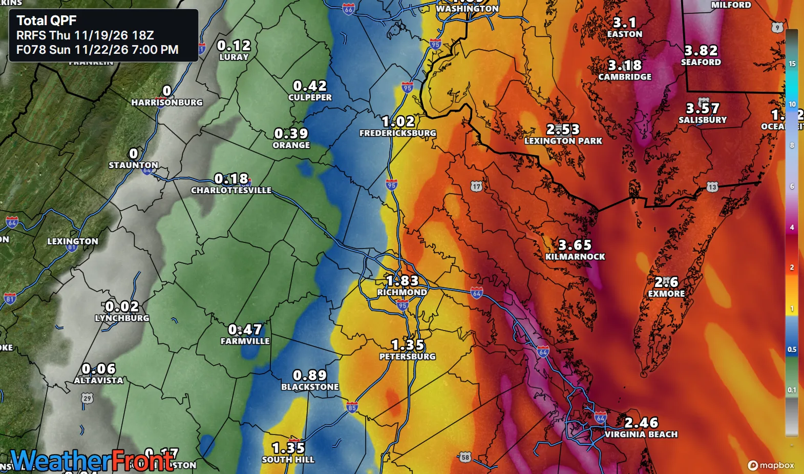
KEY HIGHLIGHTS
- ☀️ Mild and tranquil through Saturday: High pressure stays overhead — near 68 Friday in the metro (mid-60s in the Piedmont, mid-60s on the Northern Neck and the Lower Eastern Shore), near 66 Saturday, light winds, and tonight's lows held higher by high clouds, in the mid-30s inland to near 40 toward the coast.
- 🌧️ Sunday rain chances are rising — the pattern-break candidate: Ensembles have edged the coastal low's track west, closer to the coast; showers are likely Sunday (70% in the metro), with a quarter to a half inch in the metro and probabilities for 1 inch east of I-95 now at 50+ percent.
- 💨 Sunday's other impacts stay modest: A brief period of gusty northeast to southeast winds at the coast Sunday, the system moving fast, and only minor tidal flooding in the worst case — it arrives at the low end of the astronomical tide cycle.
What weather question have you been saving for us?
SPECIAL FOCUS: The Low That Keeps Edging Closer
The mild stretch and Sunday's rain come from two different setups handing off. High pressure sits overhead through Saturday, with high clouds streaming in on southwest flow aloft — enough to keep tonight's lows higher than the freezing starts earlier this week, while afternoons stay above normal. Along a stationary front draped across Florida and the Bahamas, a coastal low tries to form this weekend; where it forms decides how strong it gets. Ensembles have edged its track west, closer to the coast, while the GFS brings a strong low onshore in the Carolinas and the ECMWF keeps it slower and weaker. Think of a sprinkler slowly swinging toward the yard. Translated into plain English: the closer track wins more rain for us, especially east of I-95.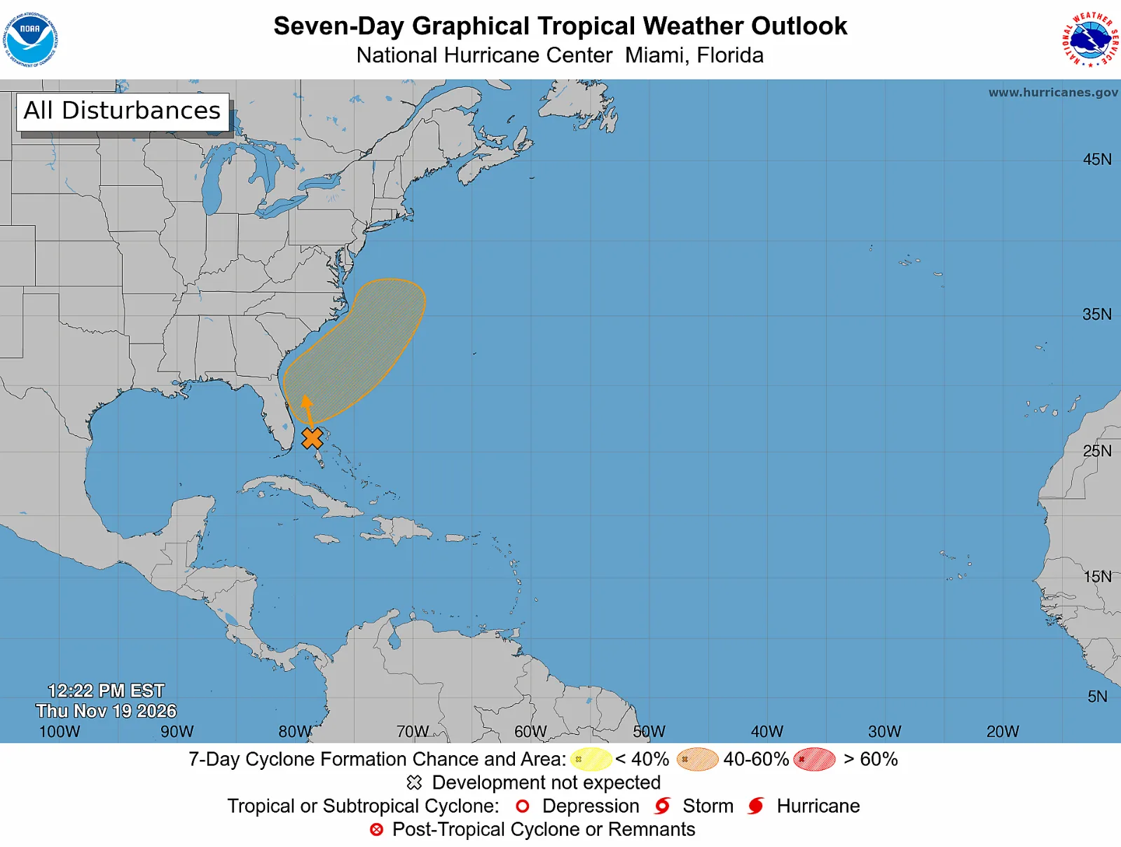
What could change this: Sunday's totals — if the low forms farther east and stays weak like the ECMWF shows, the metro sees very little rain and the dry spell runs on; a closer, stronger track like the GFS brings a soaking east of I-95.
DETAILED FORECAST
Friday (Nov 20): Increasing clouds, high near 68 in the metro, mid-60s in the Piedmont, mid-60s on the Northern Neck and the Lower Eastern Shore. Calm wind becoming northeast around 5 mph. Low Friday night around 38 in the metro, mid-30s inland, near 40 toward the coast. Mild and easy — the pick of the weekend starts here.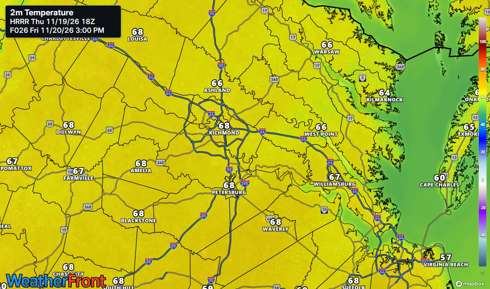
Saturday (Nov 21): Partly sunny, high near 66 regionwide — mid-60s in the Piedmont, mid-60s on the Northern Neck and the Lower Eastern Shore. Northeast wind 3 to 6 mph. Low Saturday night around 49 — much milder as clouds thicken — with a 40% chance of showers after 1 AM, under a tenth of an inch. Do the outdoor jobs Saturday; rain knocks late.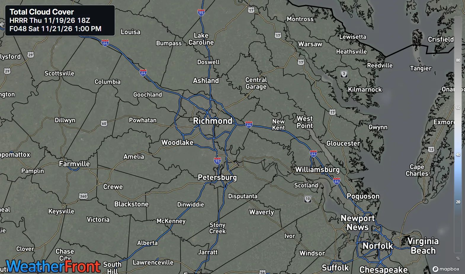
Sunday (Nov 22): Showers likely, mostly cloudy, high near 64 in the metro, low to mid-60s in the Piedmont, mid-60s on the Northern Neck and the Lower Eastern Shore. Rain chance 70% in the metro and higher east of I-95; a quarter to a half inch in the metro, with a 50+ percent chance of 1 inch east of I-95. Brief gusty winds at the coast. Low Sunday night around 51, showers ending before 1 AM. The dry spell's first real test.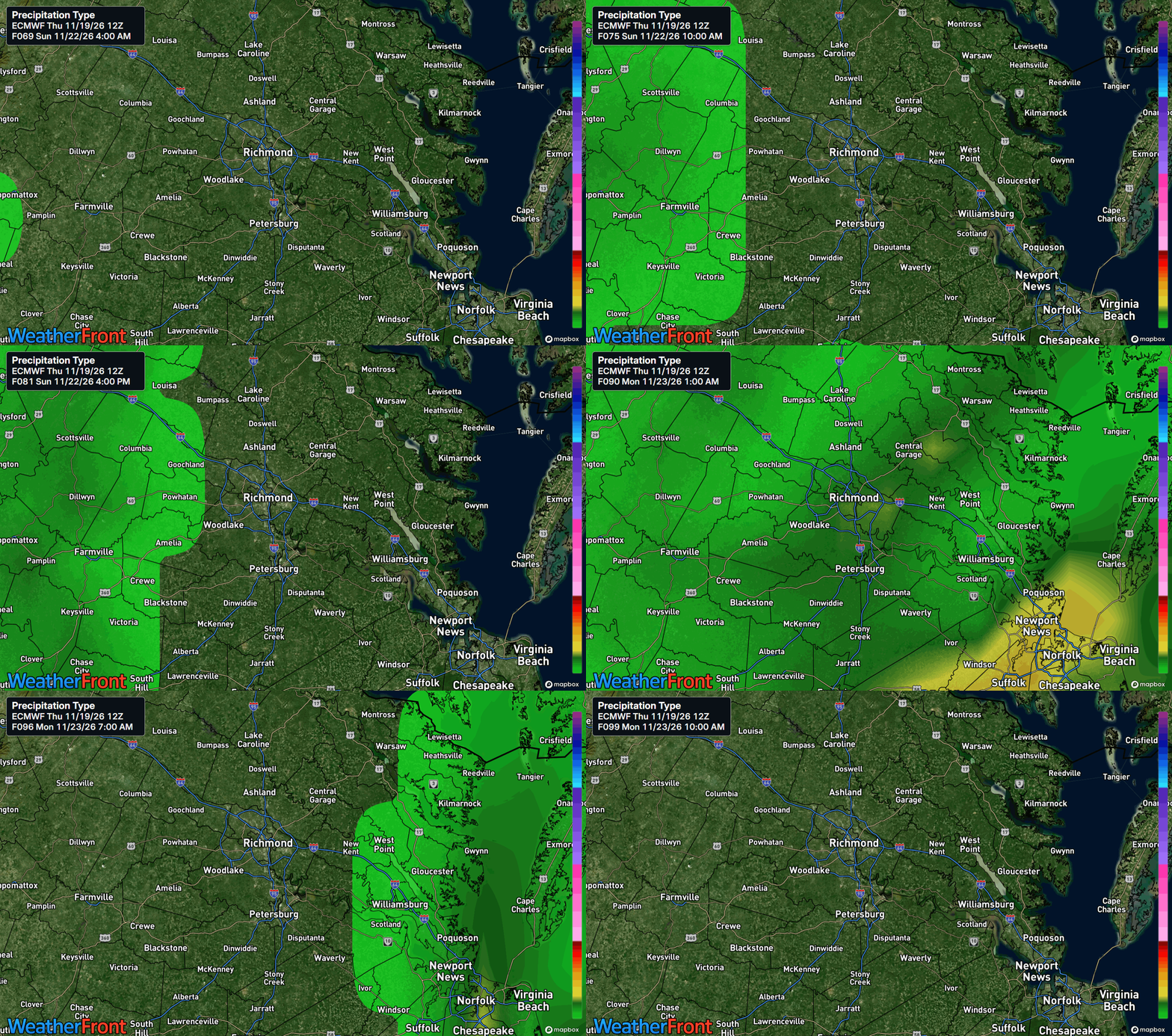
AT A GLANCE
Fri: Increasing clouds, mild — 68°
Sat: Partly sunny, quiet — 66°
Sun: Showers likely — 64°
Monday: Showers end, mostly sunny, near 68 — another storm signal by Thanksgiving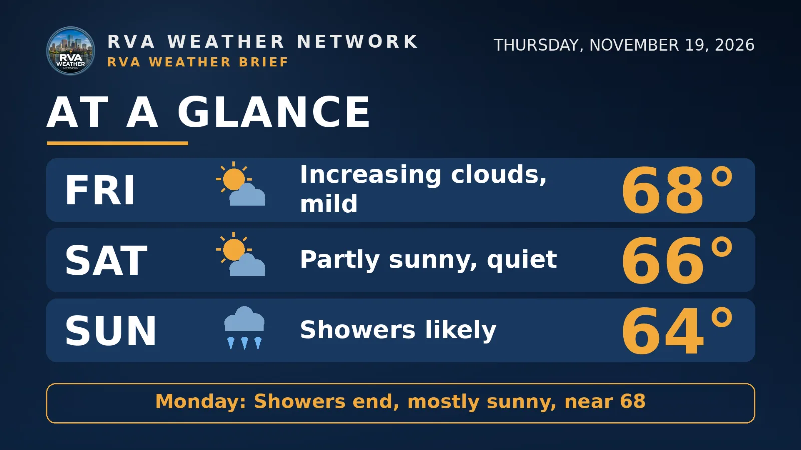
SPECIALIZED CALLOUTS
🌱 Gardening & Soil Brief: Two more dry, mild days to finish fall cleanup and water new plantings deeply — the soil is still dry going in. Sunday's quarter to a half inch in the metro (more east of I-95) is the first real help in weeks; hold off on any last watering Saturday and let the rain do it.
🚗 Commute & Outdoor Rating: 8/10. Friday and Saturday are dry, mild, and light-wind — ideal for the commute and outdoor work. Points come off for Sunday only: likely showers, wet roads all day, and brief gusty winds at the coast.
🏠 Home & Energy Brief: The heating bill gets a break — lows climb from the mid-30s tonight to around 49 Saturday night and 51 Sunday night as clouds and rain arrive. No freeze risk this window inland; you can ease the thermostat watch until colder, dry air returns Tuesday.
🚴 Two-Wheel & Runner's Outlook: Friday and Saturday are the riding and running days — mid to upper 60s, dry roads, light northeast winds. Sunday is a wet-kit day: likely showers and a high near 64, so front-load the miles to Saturday morning.
COMMUNITY ENGAGEMENT
📩 Reader Mailbag is open — send us your weather question: Pick a lane — WINTER, FREEZE, RAIN, or SKY — plus your neighborhood, and post your question as a comment on this issue's page: https://rvaweather.net/newsletter/post/mild-through-saturday-then-sundays-rain-moves-closer/#comments — we will answer one in an upcoming issue. Like this if yours has been sitting unasked all fall.
📩 Share & Subscribe: Send this to anyone with outdoor weekend plans — Saturday is the dry, mild day to use, and Sunday's rain timing decides the rest. Know a neighbor who'd want Richmond's weather in their inbox? Forward this email their way — word of mouth is how the Brief grows. Get the brief in your inbox: https://rvaweather.net/newsletter
Thanks for reading the RVA Weather Brief — 100% free, from the RVA Weather Network team. Support our work at https://rvaweather.net/social. Built on the latest NWS Wakefield forecast discussion (2:57 PM EST Thu Nov 19, 2026 — the latest available at generation time; no post-3:00 PM discussion had been issued yet), with local context from the RVA Weather Network team. Keep an eye on the sky — and stay safe out there.
Comments