
Tuesday was the hinge — mid-50s to lower 60s under high pressure, with the trough that chilled the weekend finally sliding south and east. The turn now is sunshine doing slow, steady work: sunny and dry Wednesday through Friday, highs climbing from the mid-60s to near 70, while clear, calm nights still pool cold inland below freezing tonight and Wednesday night. The payoff is a pleasant late-week stretch — just do not plan on rain, because Sunday's chance is still a coin flip.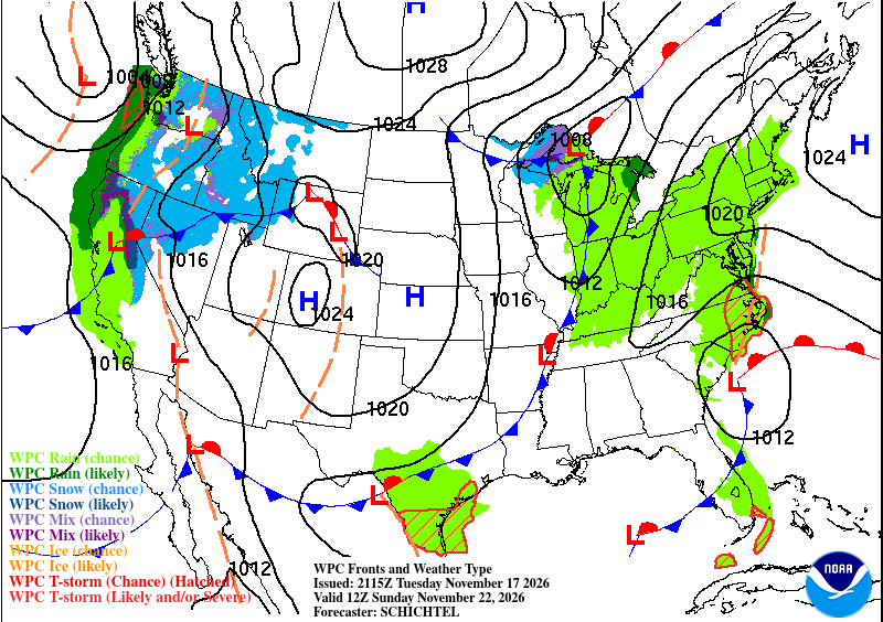
KEY HIGHLIGHTS
- 🥶 Two more freezing nights inland, then the cold eases: Widespread lows below freezing in the Piedmont and inland metro tonight and Wednesday night — upper 20s to low 30s inland, low to mid-30s on the Northern Neck, mid-30s on the Lower Eastern Shore — then mid to upper 30s Thursday and Friday nights.
- ☀️ A few degrees warmer every day: Sunny and dry Wednesday through Friday under anchored high pressure — mid-60s Wednesday, upper 60s Thursday, upper 60s to 70 Friday and into Saturday, with light winds all week.
- 🌧️ Sunday rain is a genuine coin flip: A Gulf Coast low tracks northeast this weekend; the GFS brings it up the coast while the ECMWF keeps it weak and offshore — ensemble medians show little to no rain, confidence in a wetting rain west of I-95 is extremely low, and any rain favors the coast late Saturday night into Sunday.
What do you think Wednesday morning will look like at your house?
SPECIAL FOCUS: One High, Two Different Days
The cold nights and the warm afternoons are coming from the same setup. Surface high pressure stays anchored over us while upper-level ridging slowly builds overhead and the trough that chilled the weekend slides south and east. Each clear, calm night lets inland cold pool again — below freezing tonight and Wednesday night — while each sunny day adds a few degrees, until highs reach the upper 60s to 70 Friday. Think of a lid that traps cold at night and sunshine by day. Translated into plain English: the high is not moving, so we warm by sunshine alone, not by a new air mass — and the dry spell runs on. The next actor, a closed low near the Gulf Coast, only arrives this weekend.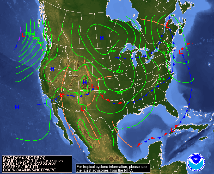
What could change this: Sunday's rain — if the Gulf low tracks closer to the coast like the GFS shows, we get a real rain; if it stays weak and offshore like the ECMWF, the dry spell simply continues.
DETAILED FORECAST
Wednesday (Nov 18): Sunny and dry, high in the low to mid-60s in the Piedmont, mid-60s in the metro, low to mid-60s on the Northern Neck and the Lower Eastern Shore. Light and variable winds. Low Wednesday night below freezing inland again — upper 20s to low 30s inland, mid-30s toward the coast; patchy ground fog is possible near the Peninsula. Cold start, pleasant finish.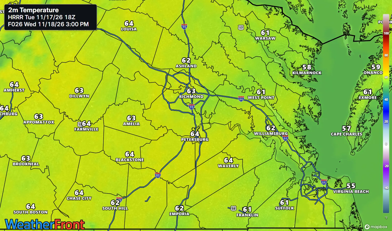
Thursday (Nov 19): Sunny and milder, high in the mid to upper 60s in the Piedmont and the metro, mid-60s on the Northern Neck and the Lower Eastern Shore. Light winds under the ridge. Low in the mid to upper 30s — the first night this week most places stay above freezing. The warm-up finds its stride.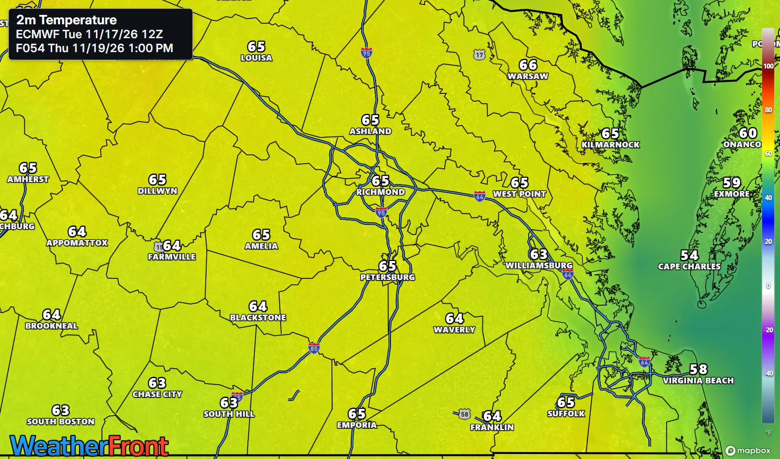
Friday (Nov 20): Sunny and dry, high in the upper 60s in the Piedmont, near 70 in the metro, upper 60s on the Northern Neck and the Lower Eastern Shore. Light winds continue. Low in the mid to upper 30s. Near 70 in late November — take the afternoon outside.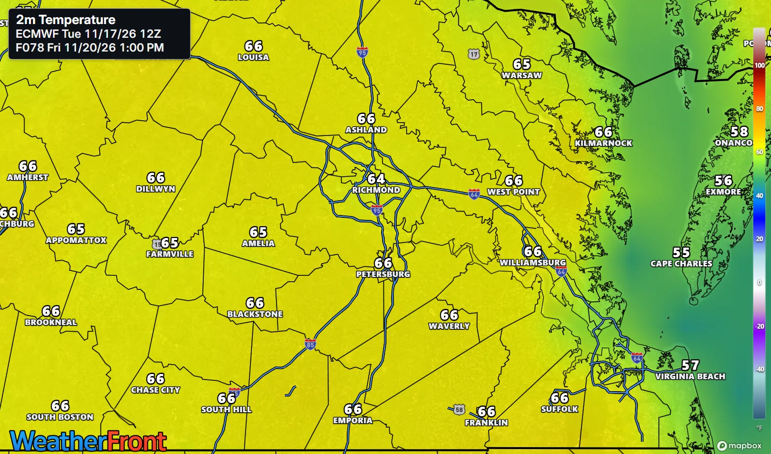
AT A GLANCE
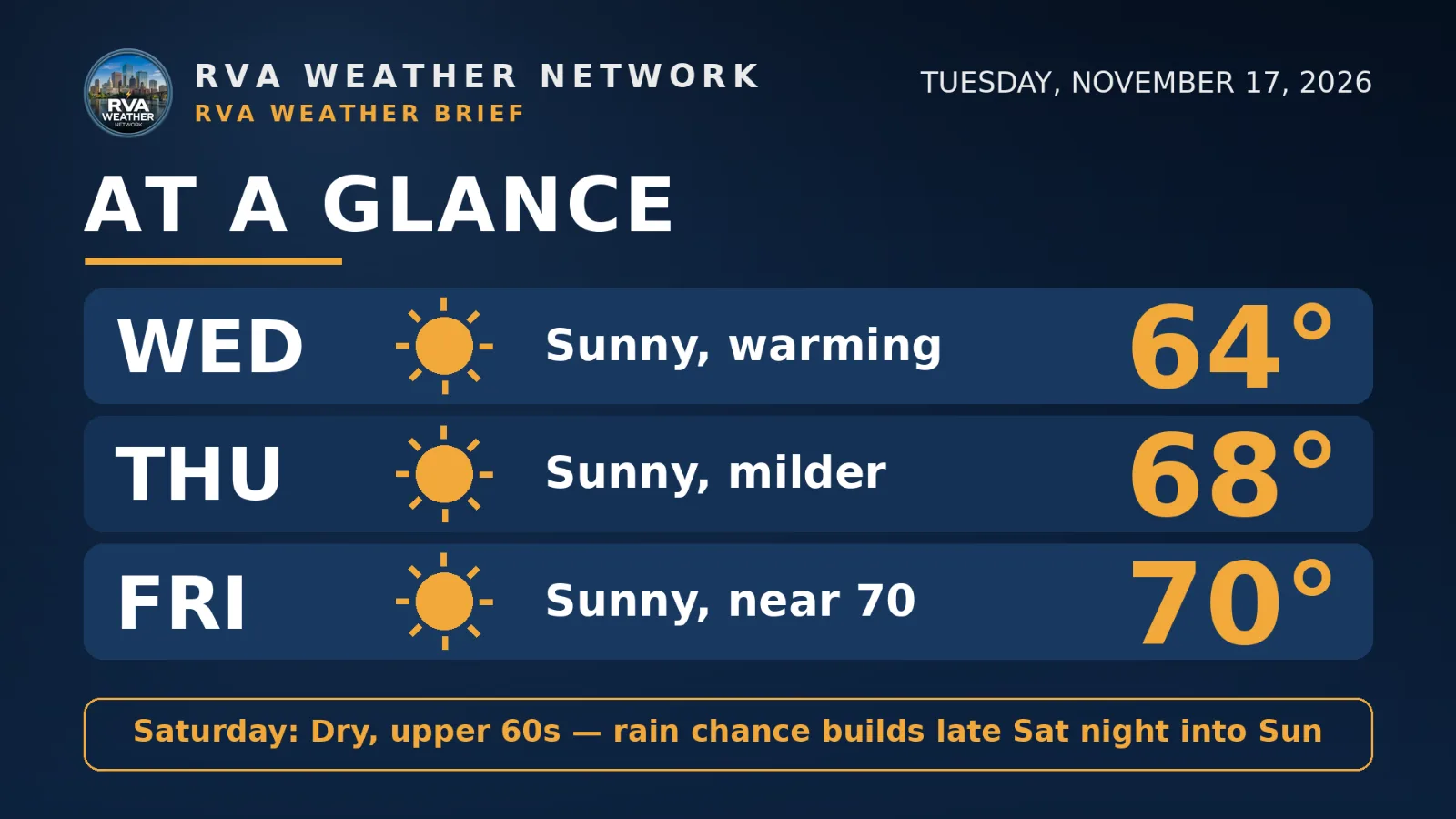
Wed: Sunny, warming — 64°
Thu: Sunny, milder — 68°
Fri: Sunny, near 70 — 70°
Saturday: Dry, upper 60s — rain chance builds late Sat night into Sun
SPECIALIZED CALLOUTS
🌱 Gardening & Soil Brief: The growing season is over and the soil is dry — two more freezing nights inland finish anything tender, and there is no reliable rain before Sunday at the earliest. Water new trees, shrubs, and pansies deeply this week; do not count on the weekend.
🚗 Commute & Outdoor Rating: 9/10. Three dry, sunny days with light winds — ideal for the commute and outdoor work. The only point off is Wednesday morning: patchy fog possible near the Peninsula, and inland windshields need a scrape.
🏠 Home & Energy Brief: Heating still runs at night — below freezing inland tonight and Wednesday night — but Thursday and Friday nights ease to the mid to upper 30s. Keep pipes protected one more night inland, then the heating bill trends down.
🚴 Two-Wheel & Runner's Outlook: Mornings are winter kit through Wednesday — upper 20s to low 30s inland at sunrise. Afternoons are the pick: mid-60s Wednesday, upper 60s Thursday, near 70 Friday, dry roads and light winds.
COMMUNITY ENGAGEMENT
🌫️ Wednesday-morning frost-and-fog check — what greets you at sunrise? Reply HEAVY FROST, LIGHT FROST, FOGGY, or CLEAR AND DRY, plus your neighborhood — a photo of your frosted windshield, lawn, or foggy street is welcome too. Full reports at https://rvaweather.net/obs. Like this if you are ready for near-70 afternoons after these freezing starts.
📩 Share & Subscribe: Send this to anyone planning yard work, a ride, or a run this week — near 70 by Friday with no rain to dodge is worth planning around. Know a neighbor who'd want Richmond's weather in their inbox? Forward this email their way — word of mouth is how the Brief grows. Get the brief in your inbox: https://rvaweather.net/newsletter
Thanks for reading the RVA Weather Brief — 100% free, from the RVA Weather Network team. Support our work at https://rvaweather.net/social. Built on the latest NWS Wakefield forecast discussion (2:16 PM EST Tue Nov 17, 2026 — the latest available at generation time; no post-3:00 PM discussion had been issued yet), with local context from the RVA Weather Network team. Keep an eye on the sky — and stay safe out there.
Comments