Richmond spent Tuesday in the mild air — upper 60s to lower 70s under clear skies — and Wednesday runs it back, sunny and dry for Veterans Day. The turn starts Thursday, when a strong cold front brings a chance of showers that keeps shrinking: odds of even a tenth of an inch of rain are only 20-50%, and a half-inch is a long shot. What the front does deliver is the cold — highs in the 50s Friday, then the first widespread sub-freezing nights of the season this weekend.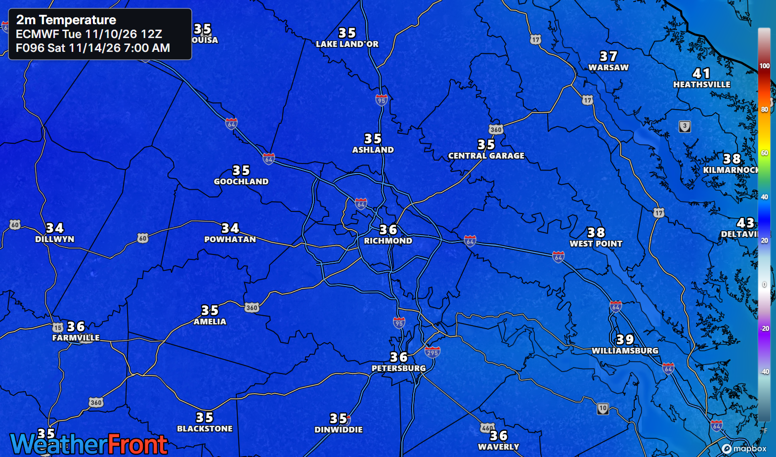
KEY HIGHLIGHTS
🌡️ One more mild day Wednesday: Sunny and dry, with highs in the upper 60s to lower 70s in the Piedmont and the metro, similar on the Northern Neck and the Lower Eastern Shore. Clouds increase late as the pattern starts to shift.
🌦️ Thursday's rain is fading: A strong cold front crosses Thursday evening into Friday, but shower chances are down to 25-40% along and north of I-64 and under 25% south of it. Do not count on this front to water anything.
🥶 The first widespread freeze arrives this weekend: Friday highs only reach the 50s, Saturday is the coldest day with highs in the lower 50s, and lows fall to the upper 20s to around freezing away from the coast Friday, Saturday, and Sunday nights. NWS expects a Freeze Watch will likely be needed — the growing season is ending for most of us.
Covering up Friday night, or letting it go?
SPECIAL FOCUS: The Trough That Digs In and Stays
This cold shot starts northwest of us. On Wednesday a shortwave trough dives south out of the north-central U.S., and by Thursday and Friday it has grown into a large, anomalously strong longwave trough with an embedded upper low parked over most of the eastern U.S. Think of it as a deep dent in the jet stream that refuses to move on. A series of cold fronts crosses Thursday evening and overnight, and behind them, cold-air advection on gusty northwest winds pours the season's coldest air into Virginia. Translated into plain English: the mild air is not easing out — it is being evicted, and the new tenant stays through the weekend.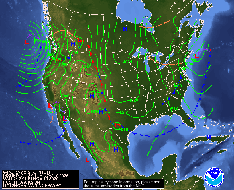
What could change this: Thursday's rain — if the trough digs slower, showers could organize into something steadier; right now both ensembles give even a 0.50-inch total negligible odds.
DETAILED FORECAST
Wednesday (Nov 11): Sunny and dry for Veterans Day, high in the upper 60s to lower 70s in the Piedmont and the metro, similar on the Northern Neck and the Lower Eastern Shore. Light southwest winds turn calm tonight, with lows in the low to mid 40s. Clouds increase late. The last easy day — November at its friendliest.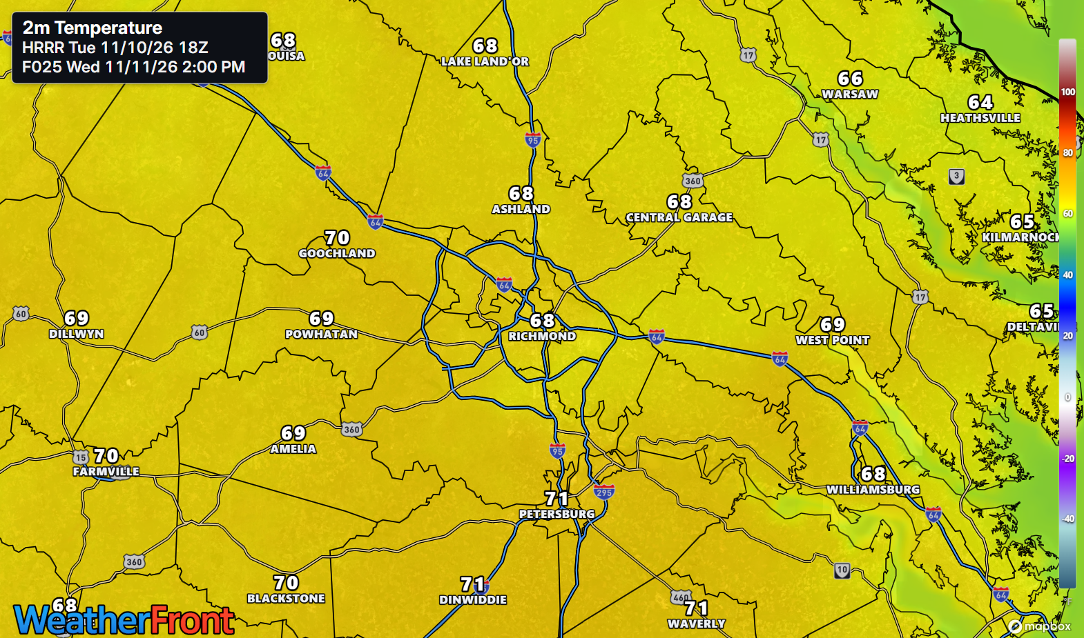
Thursday (Nov 12): The last mild day for a while, high in the mid to upper 60s, around 70 in the southeast. Isolated to scattered showers are possible, with chances of 25-40% along and north of I-64 and under 25% to the south; most places stay dry. A series of fronts crosses in the evening and overnight, and temperatures fall behind them. Warm at lunch, a jacket by bedtime.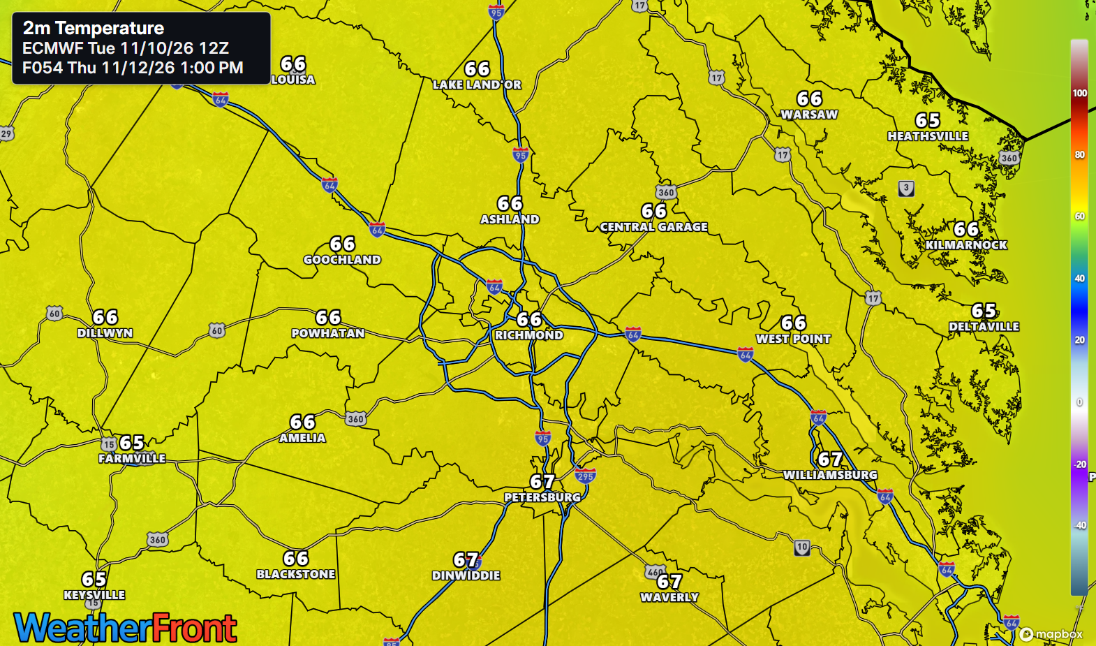
Friday (Nov 13): Much cooler, high only in the 50s regionwide, with gusty northwest winds making it feel colder. A lingering shower chance of 15-20% is confined to the Eastern Shore; the metro and the Piedmont dry out behind the front. Low in the upper 20s to around freezing away from the coast — colder in the Piedmont, a few degrees milder on the Lower Eastern Shore. The eviction notice — winter knocks for real.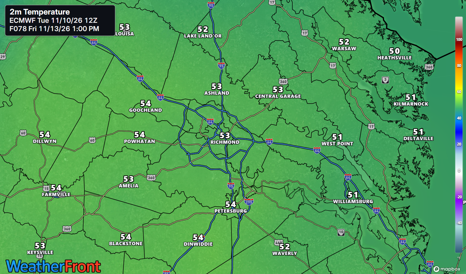
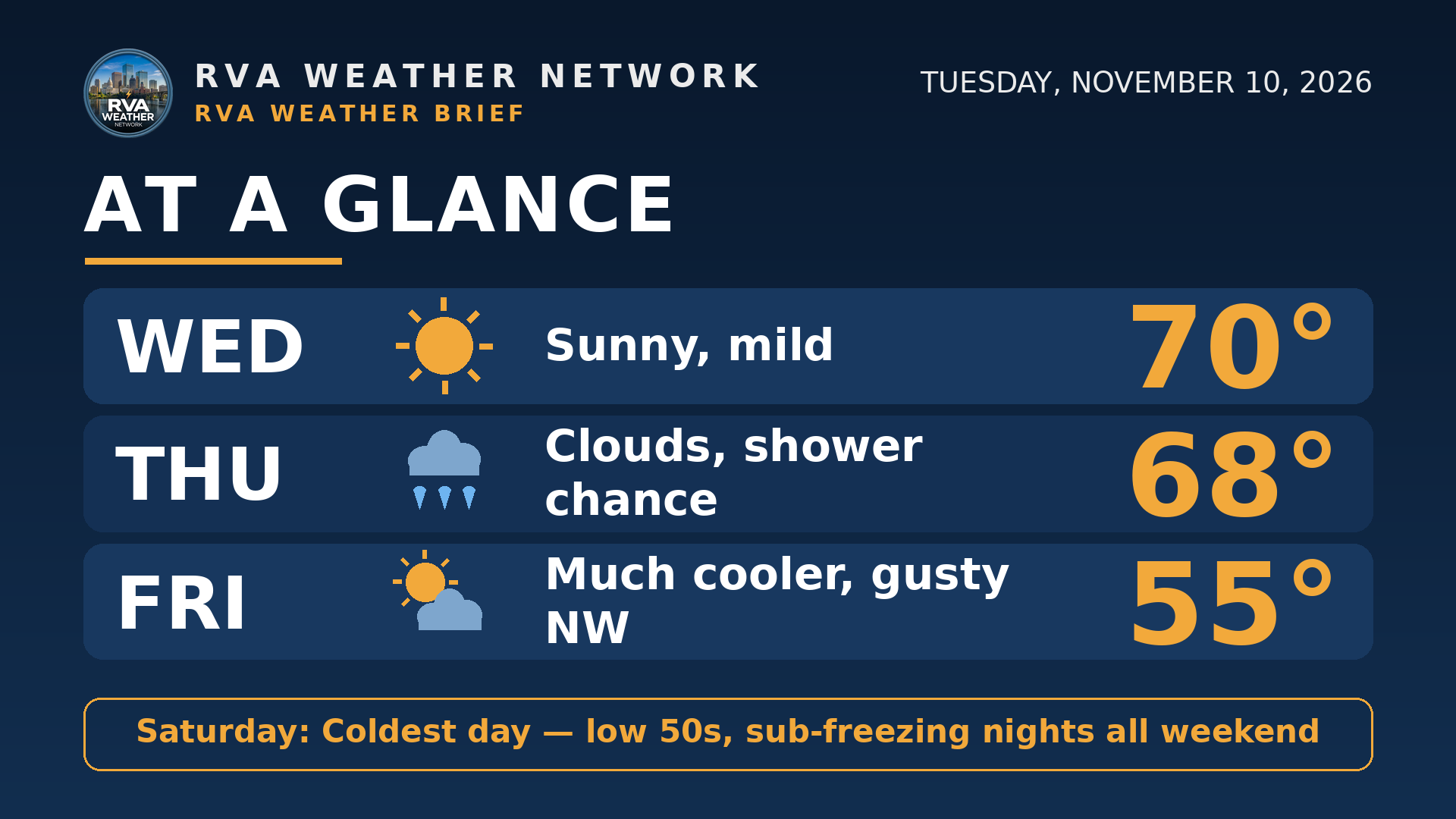
AT A GLANCE
Wed: Sunny, mild — 70°
Thu: Clouds, shower chance — 68°
Fri: Much cooler, gusty NW — 55°
Saturday: Coldest day — low 50s, sub-freezing nights all weekend
 SPECIALIZED CALLOUTS
🌱 Gardening & Soil Brief: Treat Friday night as the deadline — lows in the upper 20s to around freezing away from the coast end the growing season for most of us. Harvest what's left and bring tender pots in by Friday evening; Thursday's fading showers will not water anything in.
🚗 Commute & Outdoor Rating: 8/10. Wednesday is flawless — dry, sunny, near 70 for Veterans Day plans. Points come off for Thursday evening's shower chance and Friday's gusty northwest winds on bridges and exposed roads.
🏠 Home & Energy Brief: Heating demand steps up hard Friday night and stays up all weekend, with three straight sub-freezing nights inland. Wednesday is the day to check the furnace and protect exposed pipes before the cold arrives, not during it.
🚴 Two-Wheel & Runner's Outlook: Wednesday afternoon is the pick of the stretch — dry, light winds, near 70. Friday flips it: gusty northwest headwinds and highs in the 50s, and Saturday morning starts in the upper 20s inland — full winter kit.
COMMUNITY ENGAGEMENT
🥶 Saturday-morning freeze check — what did Friday night do at your house? Reply FROST ONLY, HARD FREEZE, or STILL GREEN, plus your neighborhood — a frost photo is welcome too. Full reports at https://rvaweather.net/obs. Like this if you are covering or bringing plants in Friday night.
📩 Share & Subscribe: Send this to anyone with tender plants still outside, or weekend plans built on 60s — Friday night changes both. Get the brief in your inbox: https://rvaweather.net/newsletter
Thanks for reading the RVA Weather Brief — 100% free, from the RVA Weather Network team. Support our work at https://rvaweather.net/social. Built on the latest NWS Wakefield forecast discussion (1:54 PM EST Tue Nov 10, 2026 — the latest available at generation time; no post-3:00 PM discussion had been issued yet), with local context from the RVA Weather Network team. Keep an eye on the sky — and stay safe out there.
Comments