
Sunday's rain arrived as a light, uneven affair — showers confined mostly to the Piedmont this afternoon, pushing northeast this evening with a quarter inch or less, lightest east of I-95. Monday flips mild and mostly sunny near 72 before a cold front slips through late with a few scattered showers, and Tuesday turns sharply cooler in the mid-50s. 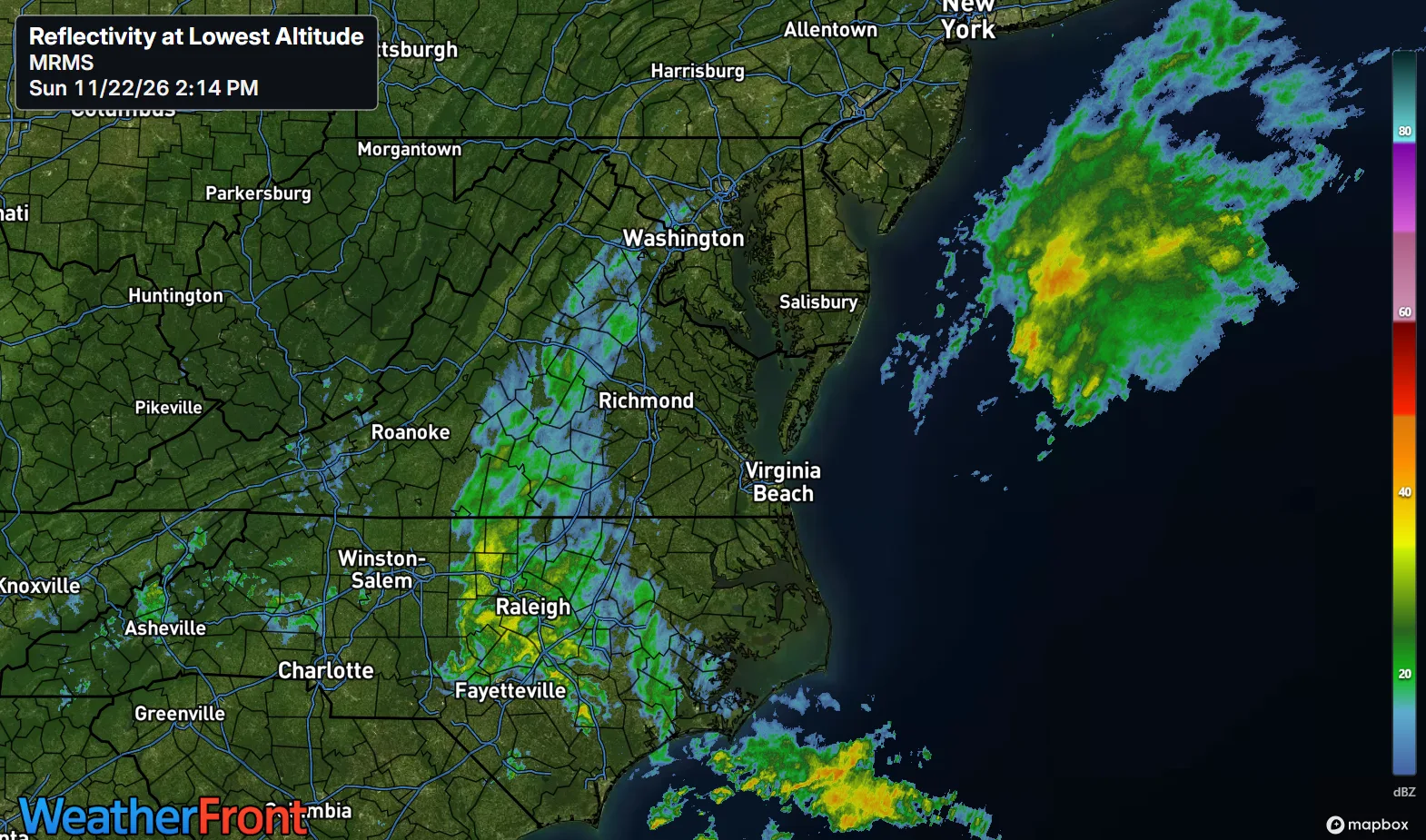
The payoff is timing: use Monday and Tuesday, because a stronger coastal storm is taking shape for Wednesday night into Thanksgiving.
KEY HIGHLIGHTS
- 🌧️ Sunday's rain stays light: Showers push northeast this afternoon into evening, generally 0.25 inch or less area-wide — highest southwest, less than a tenth in the metro — with mild lows tonight in the lower 50s northwest to upper 50s southeast.
- ☀️ Monday mild, Tuesday cool: Mostly sunny and near 72 Monday in the metro (lower 70s Piedmont and Northern Neck, near 70 Lower Eastern Shore), a 30% late shower chance with the front, then sunny, breezy and near 55 Tuesday.
- 🦃 Thanksgiving storm confidence is rising: A coastal low strengthens Wednesday into Thanksgiving — heavy rain possible (20–40% odds of 2+ inches, higher at the coast), strong NE winds, and tidal flooding with elevated tides. Track and totals are still uncertain.
How much rain are you expecting at your house?
SPECIAL FOCUS: Two Lows, Two Very Different Storms
This week's story is a handoff between two coastal lows. Today's is weak and split — one low off Virginia, one off the Carolinas — so its rain stays light and patchy, mostly a Piedmont event until evening. Behind it, a cold front crosses Monday, wrings out a few late showers, and opens the door to Canadian high pressure: sunny, breezy, and only mid-50s Tuesday. That high, possibly stronger than 1040 mb over eastern Canada, then becomes Wednesday's problem — it blocks and squeezes the next coastal low against the coast, tightening the pressure gradient like a thumb over a garden hose. Translated into plain English: today's low is a nuisance; the Thanksgiving low has a wall to push against, and that is what builds wind, rain, and tides.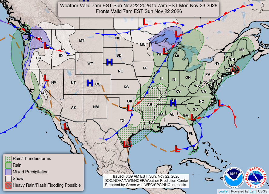
What could change this: The Thanksgiving totals — if the low tracks farther offshore, heavy rain and flooding shrink to the coast; a closer track brings them inland.
A quick note on winter outlooks
You'll see some winter outlooks this week calling for above-normal snow in Richmond — even in a warmer-than-normal winter. Here's why we're not making that call. NOAA's Climate Prediction Center leans Virginia warmer (40–50% odds) and wetter (50–60% odds near Richmond) for December through February, and CPC doesn't issue a snowfall outlook at all — because here, wet only becomes snow when cold air shows up with the storm. Richmond's El Niño winters prove it: 29.4 inches in 1982–83, 1.2 inches in 1997–98, at nearly the same ocean signal. So our call stays the same: an active, stormy winter with real snow chances when the patterns line up — and no snow totals sold in November.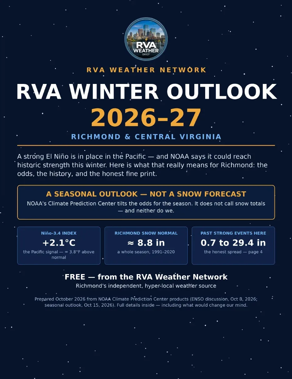
DETAILED FORECAST
Monday (Nov 23): Mostly sunny, high near 72 in the metro, lower 70s in the Piedmont and Northern Neck, near 70 on the Lower Eastern Shore. Shower chance 30% after 4 PM with the front, under a tenth of an inch. Low around 38, north winds gusting to 18 mph. The warm, dry errand day — use it.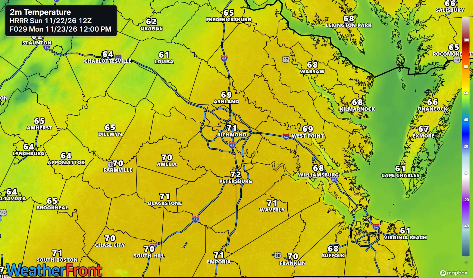
Tuesday (Nov 24): Sunny and cooler, high near 55 regionwide. North wind 9 to 11 mph, gusts to 20 mph. Low around 32 in the metro, mid- to upper 20s northwest, lower 40s at the coast. A crisp reset — and the last fully dry day.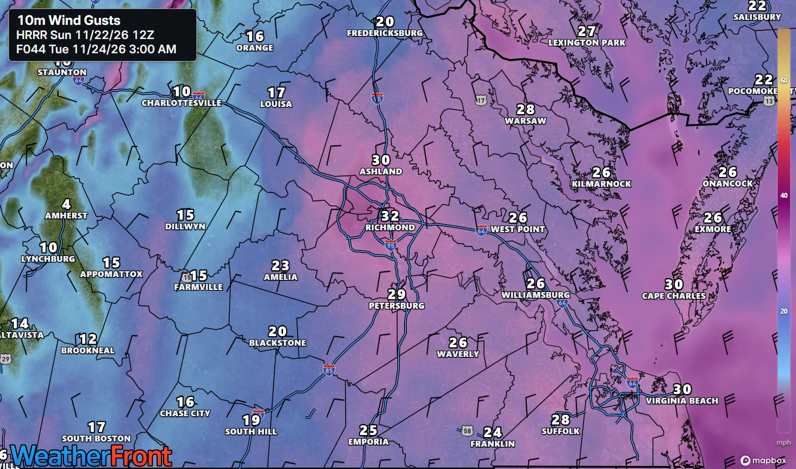
Wednesday (Nov 25): Increasing clouds, high near 55 regionwide. Rain develops Wednesday night — 90% chance in the metro, low around 46 — as the coastal low strengthens, with NE winds building at the coast. Travel early Wednesday if you can.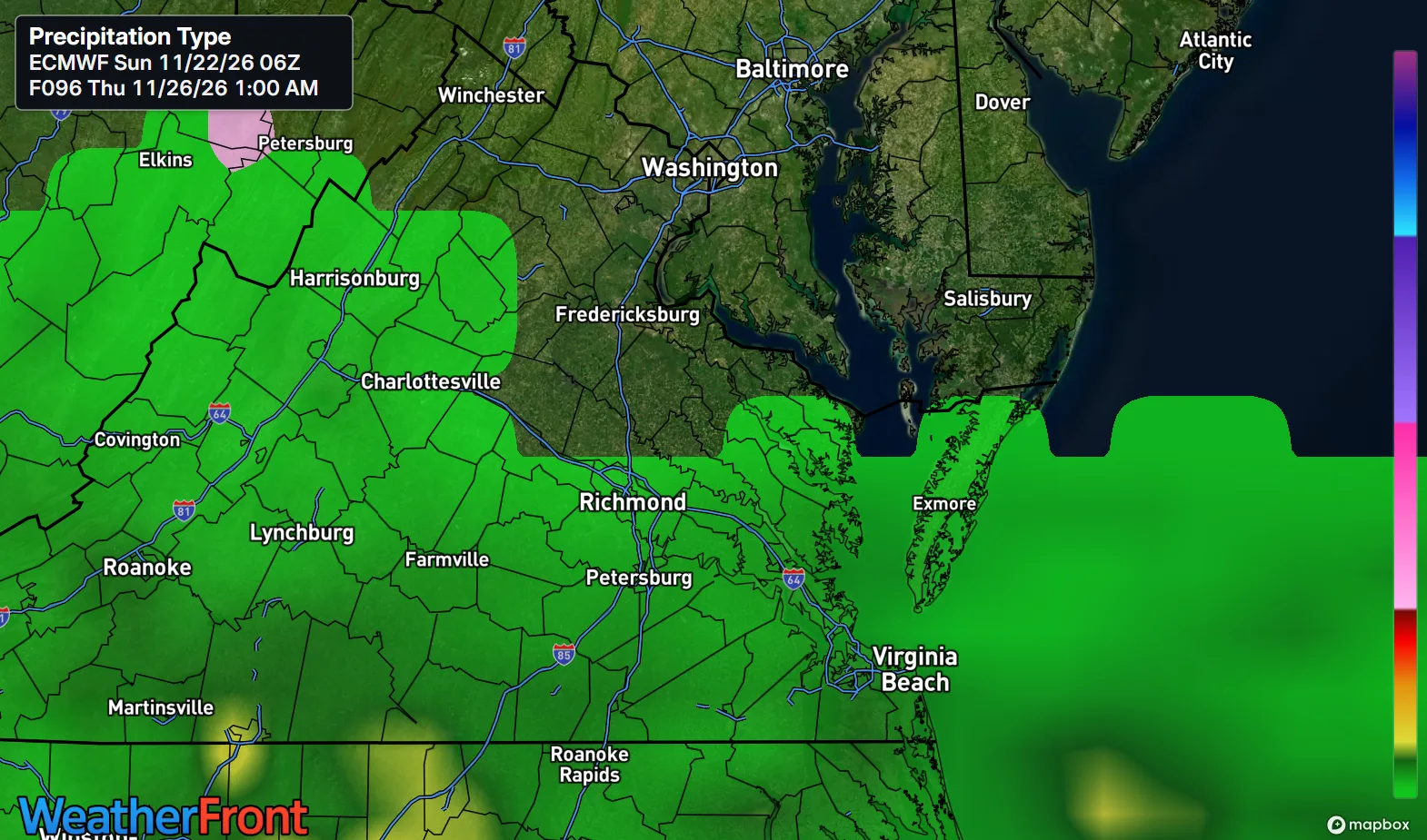
AT A GLANCE
Mon: Mostly sunny, mild — 72°
Tue: Sunny, cooler, breezy — 55°
Wed: Increasing clouds — 55°
Thanksgiving: Showers likely, breezy — 59°, coastal storm risk
SPECIALIZED CALLOUTS
🌱 Gardening & Soil Brief: Sunday's light rain barely dents the dry soil — a quarter inch or less. Monday near 72 is the day to water new plantings deeply and finish cleanup before Tuesday's freeze and Wednesday's soaking chance.
🚗 Commute & Outdoor Rating: 7/10. Monday is mild and dry until late, Tuesday sunny and breezy. Points off for Sunday evening's wet roads, Monday night's gusts to 18 mph, and Wednesday night's rain.
🏠 Home & Energy Brief: A mild night tonight (low 53) and a warm Monday cut heating, then Tuesday night drops to around 32 — protect exposed pipes inland and expect the furnace back on through Thanksgiving.
🚴 Two-Wheel & Runner's Outlook: Monday is the pick — near 72, dry roads, light winds until the late front. Tuesday is crisp and breezy near 55; Wednesday turns cloudy, with rain arriving at night.
ROTATING PROMO SLOT
🎉 New — support the network as a member: Buy Me a Coffee memberships are live — Supporter $5/mo and Founding Supporter $10/mo, with your name on the supporter wall and early access to special editions: https://buymeacoffee.com/rvawx/membership
COMMUNITY ENGAGEMENT
🌧️ Sunday rain-gauge check — what did the storm leave you? Reply TRACE, A TENTH, A QUARTER, or SOAKED, plus your neighborhood — let's map who got the Piedmont rain and who stayed dry. Full reports at https://rvaweather.net/obs. Like this if Monday's 72° is already on your plan.
❄️ Before you go — the winter guide is here: our free RVA Winter Outlook 2026–27 takes this El Niño story the rest of the way: the setup in plain English, CPC's warmer-and-wetter lean for Virginia, and all five El Niño winters in Richmond's record books — from 0.7 inches in 2023–24 to 29.4 inches in 1982–83, at nearly the same ocean signal. It's an outlook, not a snow forecast (the guide is stubborn about that distinction, and so are we), but it's the honest map of the season ahead. Grab it free here: https://buymeacoffee.com/rvawx/e/592397
Share this with anyone driving for Thanksgiving — Wednesday night's rain timing could change their departure.
Thanks for reading the RVA Weather Brief — 100% free, from the RVA Weather Network team. Support our work at https://rvaweather.net/social. Built on the latest NWS Wakefield forecast discussion (from the 1:11 PM EST discussion, the latest available), with local context from the RVA Weather Network team — keep an eye on the sky — and stay safe out there.
Comments