
Sunday stayed in the cold pattern the weekend built — cool and cloudy, highs in the mid-50s, and a few northwest gusts to 20 mph. Tonight the clouds clear and the wind dies, and Monday is sunny and calmer in the upper 50s — but Monday night is the payoff in the wrong direction, with high pressure parked overhead and lows as low as the mid-20s inland. After that coldest night, the week turns: around 60 Tuesday, mid-60s Wednesday, upper 60s Thursday through Saturday — dry the whole way.
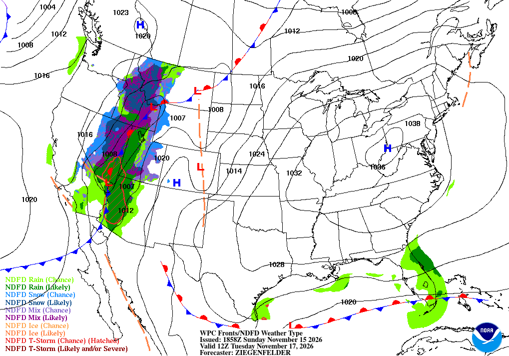
KEY HIGHLIGHTS
- 🥶 Monday night is the coldest of the stretch: High pressure almost directly overhead, clear skies and calm winds — lows as low as the mid-20s in the Piedmont and inland metro, upper 20s to low 30s on the Northern Neck, mid-30s right at the coast and on the Lower Eastern Shore.
- 🌱 The growing season is officially over for most of us: NWS Wakefield says temperatures at or below freezing Sunday morning ended it everywhere except Norfolk, Portsmouth, and Virginia Beach (and three northeast NC counties) — Frost/Freeze products resume in Spring 2027.
- ☀️ Then a slow, dry warm-up: Upper 50s Monday, around 60 Tuesday, mid-60s Wednesday, upper 60s Thursday through Saturday. Lows still drop into the 30s each morning, and there is no relief from the dry spell in sight.
How low does your thermometer go Monday night?
SPECIAL FOCUS: The Night the High Sits Right on Top of Us
Monday night's cold is not arriving on wind — it is being made right here. High pressure that started the weekend over the Midwest builds east, and by Monday night it sits almost directly overhead, while the trough that kept us chilly finally starts sliding offshore. Calm air, clear skies, and a long November night let the ground radiate the day's heat straight to space, with nothing pushing back. Think of a house with the heat off and every window cracked on a still night — the coldest rooms are the low, sheltered ones inland. Translated into plain English: no wind to stir the air and no clouds to hold heat in, so inland thermometers fall to the mid-20s while the coast, with the water nearby, holds in the mid-30s.
What could change this: Monday night's low — if bay-streamer clouds linger longer than expected, especially near the coast, lows hold a few degrees higher; inland under clear skies, the mid-20s call is solid.
DETAILED FORECAST
Monday (Nov 16): Sunny, less wind, high in the upper 50s in the Piedmont and the metro, upper 50s on the Northern Neck, mid to upper 50s on the Lower Eastern Shore. Northwest gusts fade from Sunday's 20 mph. Low Monday night as low as the mid-20s inland, mid-30s at the coast. The calm day before the coldest night.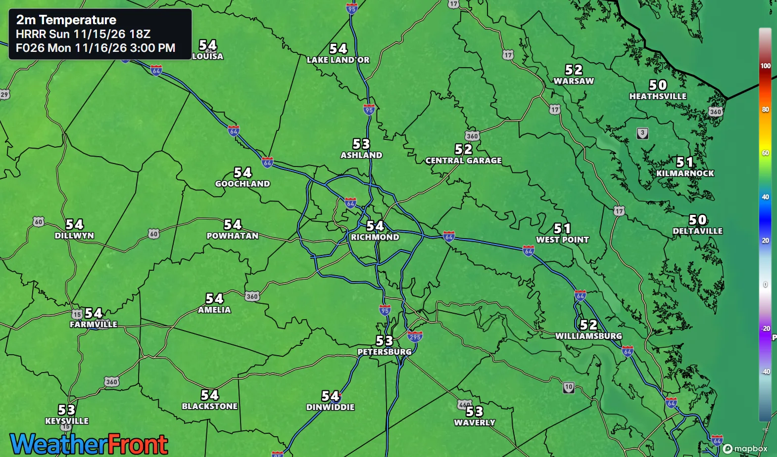
Tuesday (Nov 17): Sunny and dry, high around 60 regionwide — a touch cooler in the Piedmont, a touch milder toward the coast. Light winds under high pressure. Low in the 30s, coldest inland after Monday night's mid-20s start. The turn begins, quietly.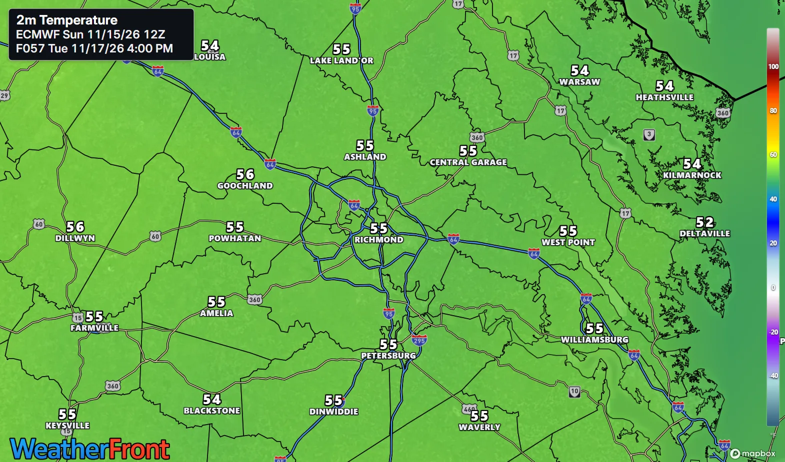
Wednesday (Nov 18): Dry with the ridge building in, high in the mid-60s in the Piedmont and the metro, mid-60s on the Northern Neck and the Lower Eastern Shore. Lows still in the 30s in the morning. Fall reminding us it can still be pleasant.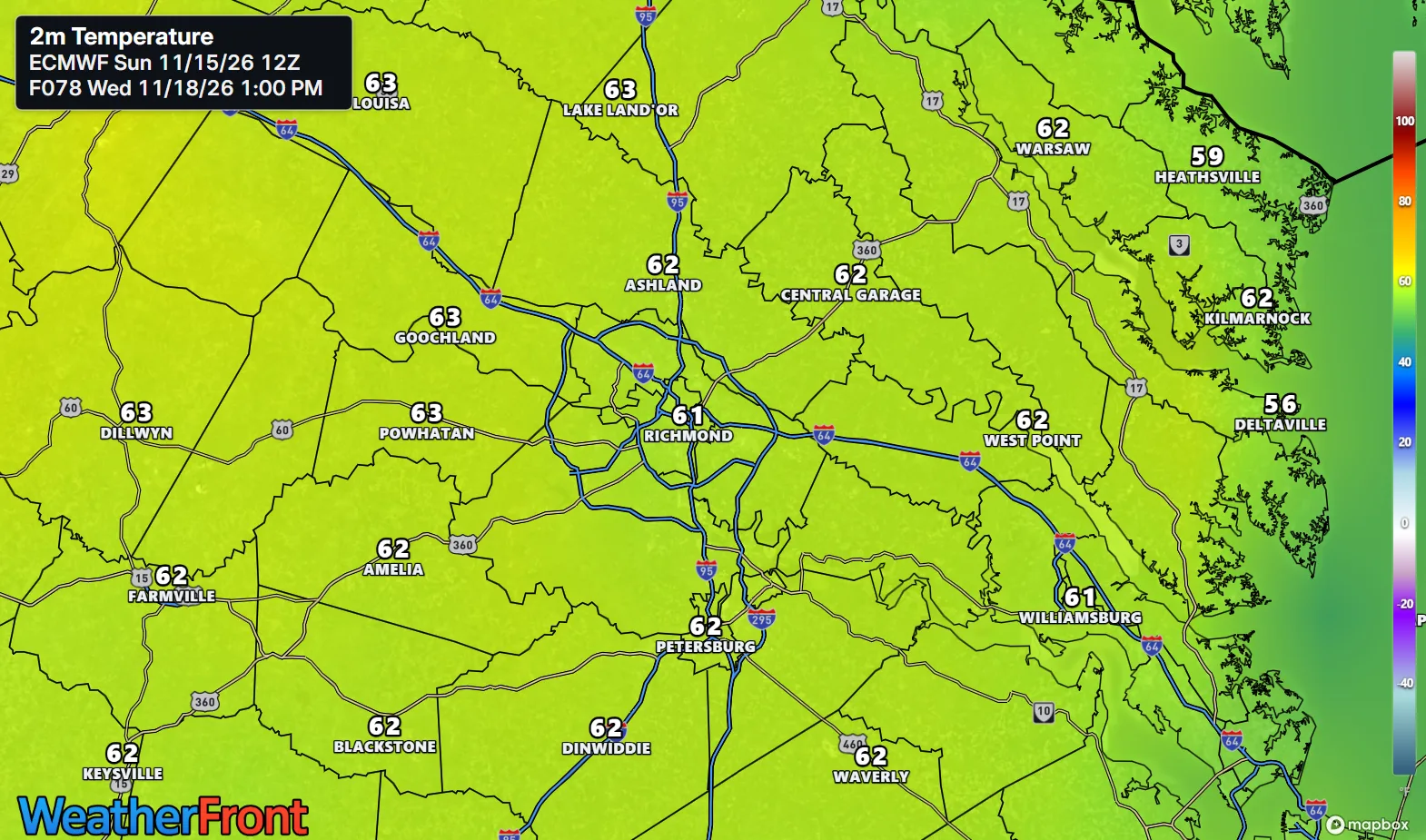
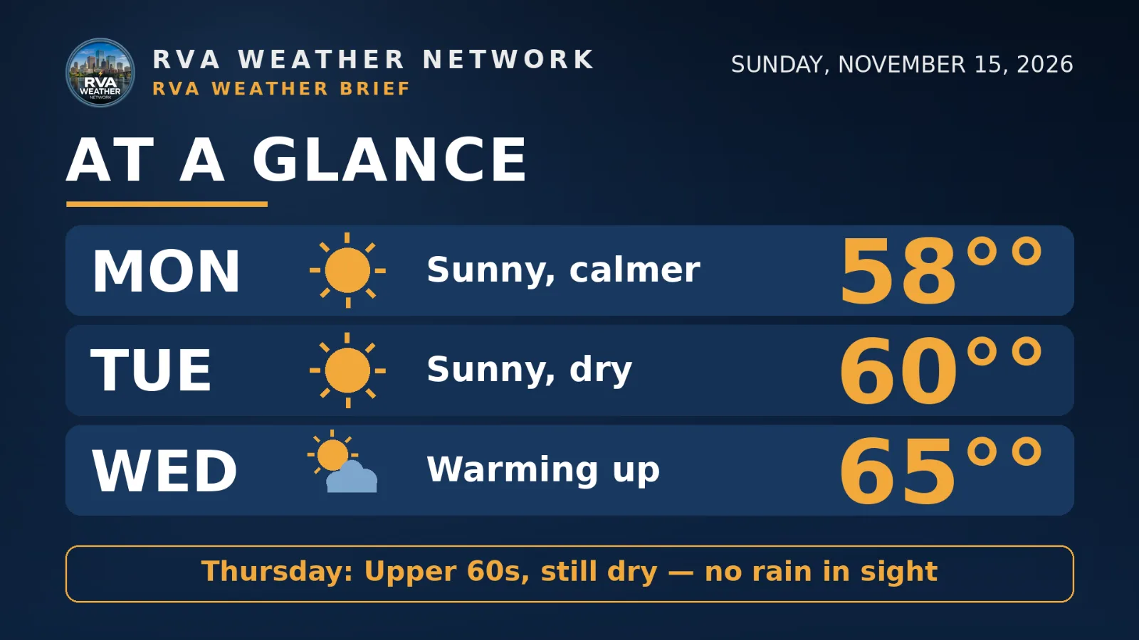
AT A GLANCE
Mon: Sunny, calmer — 58°
Tue: Sunny, dry — 60°
Wed: Warming up — 65°
Thursday: Upper 60s, still dry — no rain in sight
SPECIALIZED CALLOUTS
🌱 Gardening & Soil Brief: The season is officially closed for most of the metro and Piedmont — NWS has ended the growing season, and Monday night's mid-20s inland finish anything tender left outside. Coastal gardens near Norfolk and Virginia Beach are the only local exception; everywhere else, shift to cleanup, mulch, and protecting perennials.
🚗 Commute & Outdoor Rating: 9/10. Three dry, sunny days with light winds — Monday's gusts fade early. The only point off is for cold starts: mid-20s inland Tuesday morning means frosted windshields and extra warm-up time before the commute.
🏠 Home & Energy Brief: Monday night is the heating test — mid-20s inland is the coldest of the season so far, and lows stay in the 30s every morning this week even as afternoons warm. Protect any exposed pipes Monday evening, then let the midweek warm-up ease the heating bill.
🚴 Two-Wheel & Runner's Outlook: Monday and Tuesday mornings are full winter kit — mid-20s to 30s at sunrise inland, calm and clear. Afternoons are the pick: upper 50s Monday, around 60 Tuesday, mid-60s Wednesday with light winds and dry roads throughout.
COMMUNITY ENGAGEMENT
🌡️ Tuesday-morning low check — how cold did Monday night get at your house? Reply MID-20s, UPPER-20s, LOW-30s, or ABOVE FREEZING, plus your neighborhood — a thermometer photo is welcome too. Full reports at https://rvaweather.net/obs. Like this if Monday night was your coldest of the season so far.
📩 Share & Subscribe: Send this to anyone still deciding whether to protect pipes or bring in the last tender plants — Monday night's mid-20s inland settle both questions. Know a neighbor who'd want Richmond's weather in their inbox? Forward this email their way — word of mouth is how the Brief grows. Get the brief in your inbox: https://rvaweather.net/newsletter
Thanks for reading the RVA Weather Brief — 100% free, from the RVA Weather Network team. Support our work at https://rvaweather.net/social. Built on the latest NWS Wakefield forecast discussion (2:40 PM EST Sun Nov 15, 2026 — the latest available at generation time; no post-3:00 PM discussion had been issued yet), with local context from the RVA Weather Network team. Keep an eye on the sky — and stay safe out there.
Comments