Thursday afternoon was the last of the mild air — upper 60s to lower 70s as a cold front crossed, with only a few light showers ahead of it. Behind that front, an anomalously strong trough settles over the East and refuses to leave, dropping highs into the 50s Friday through the weekend. A Freeze Watch is up for Friday night inland, with lows of 30-32°F, an even colder Saturday night in the upper 20s, and wind chills in the mid-upper 20s — the first widespread freeze of the fall.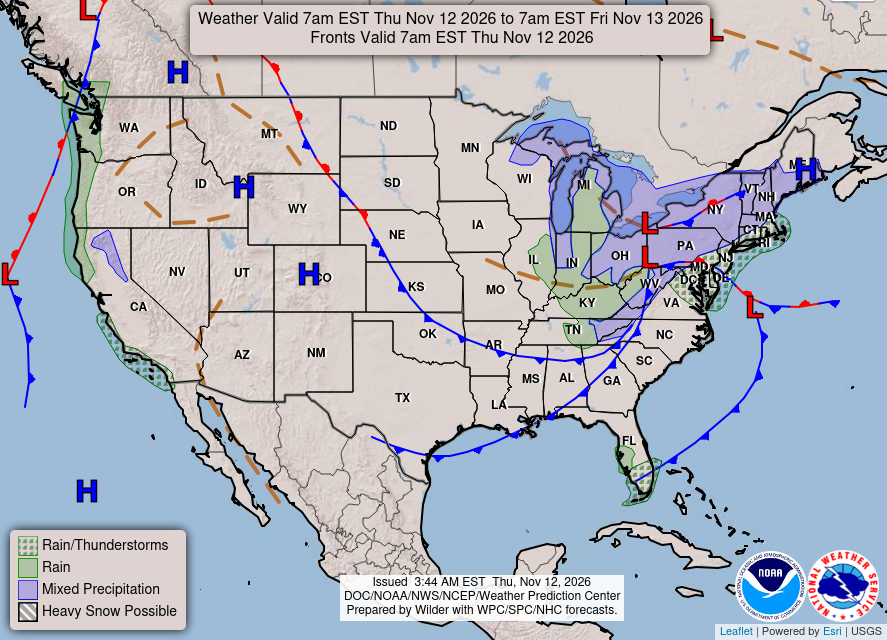
KEY HIGHLIGHTS
🥶 Freeze Watch Friday night into Saturday morning: For inland central and eastern Virginia along and east of I-95 away from the coast, plus portions of northeast North Carolina. Lows of 30-32°F inland, upper 30s to lower 40s near the coast — widespread frost ends the growing season for many inland locations.
🌬️ The coldest air of the season, and it stays: Highs in the 50s Friday through Sunday, northwest gusts 20-25 mph inland, 25-30 mph at the coast. Saturday night is colder — upper 20s inland, wind chills in the mid-upper 20s — and another Watch or Warning round may follow.
🌦️ Thursday's rain was a footnote: Isolated to scattered showers, chances of 15-25% for most of the area (25-40% on the lower Maryland Eastern Shore), any rain under 0.10 inch — most places a few hundredths at most. Dry Friday for the metro and Piedmont, dry Saturday through next week.
Send us the weather question you've always wanted answered.
SPECIAL FOCUS: The Trough That Parks and Won't Leave
This cold does not sneak in — it moves in behind a front and then sits down. Aloft, the trough over the eastern U.S. is running 2 to 3 standard deviations stronger than normal, a deep dent in the jet stream that lingers into early next week instead of sliding offshore. Fronts cross, then northwest winds keep refilling the dent with cold air Friday and again Saturday night. Think of a cold room with the door left open: each gust is another draft. Translated into plain English: this is not a one-night cold snap — the pattern itself is cold, so highs stay in the 50s and every night this weekend threatens a freeze inland.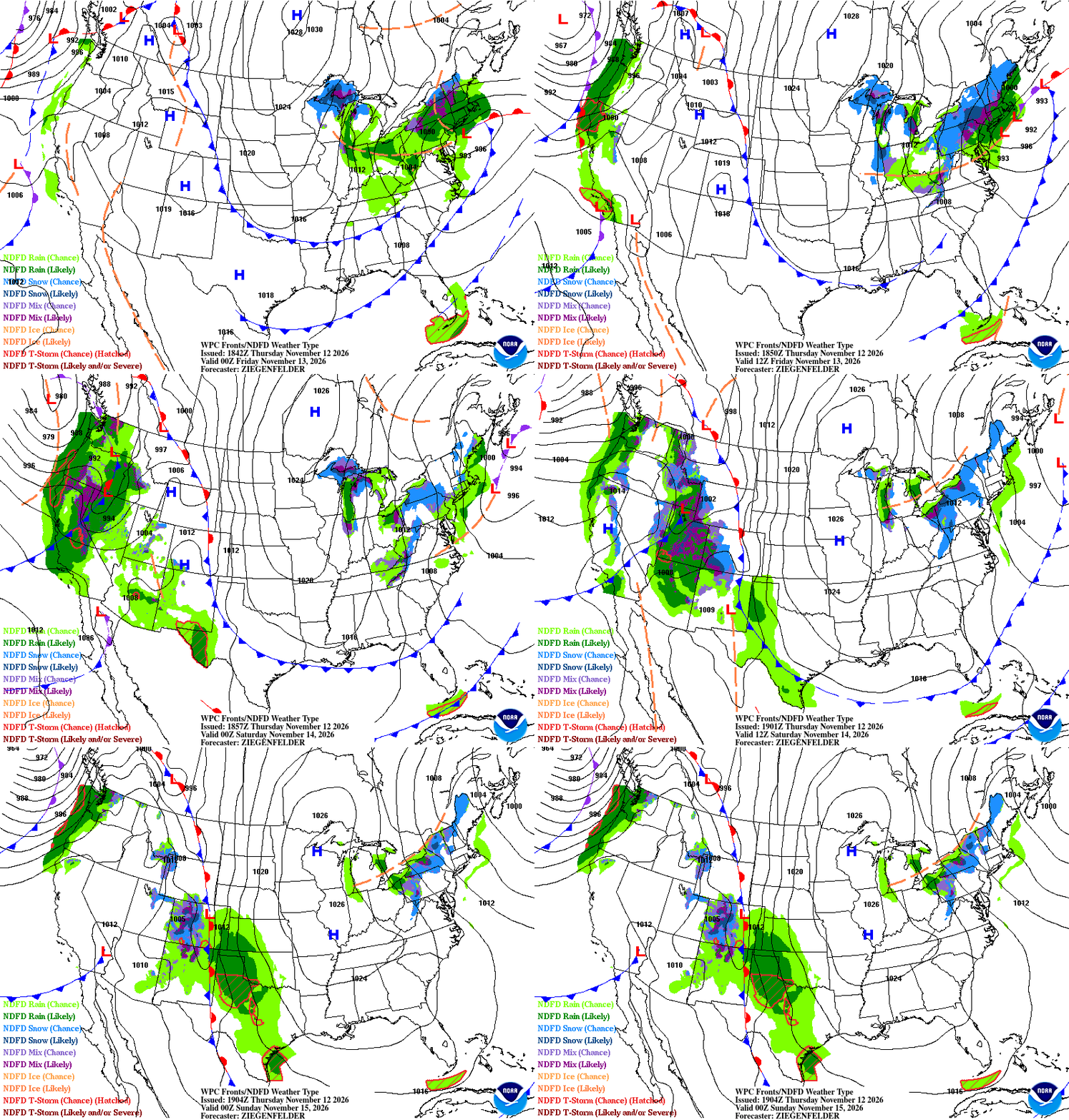
What could change this: Friday night's low — if winds stay elevated and skies stay partly cloudy, inland lows may hold just above freezing and the hardest freeze waits for Saturday night.
DETAILED FORECAST
Friday (Nov 13): Dry for the metro and Piedmont (bay-streamer showers possible only on the Eastern Shore), high in the low to mid 50s inland, mid to upper 50s toward the coast. Northwest gusts 20-25 mph inland, 25-30 mph at the coast. Low of 30-32°F inland under the Freeze Watch, upper 30s to lower 40s at the coast, wind chills in the mid-upper 20s. The door slams — cover everything Friday evening.
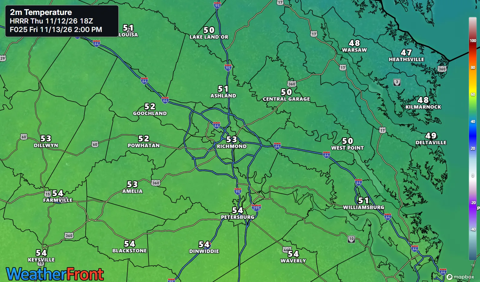
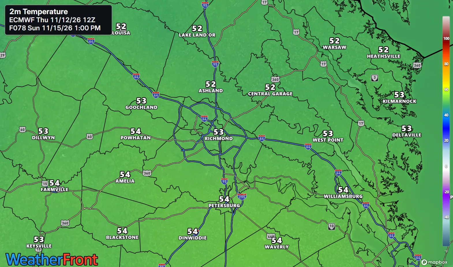
Saturday (Nov 14): Sunny and dry, high in the low to mid 50s inland, mid 50s toward the coast, with the strongest northwest winds of the weekend behind a secondary dry front. Low in the upper 20s to lower 30s inland — the coldest night of the stretch — mid 30s on the Northern Neck, upper 30s at the coast, wind chills in the mid-upper 20s. The coldest night — Saturday is the real test.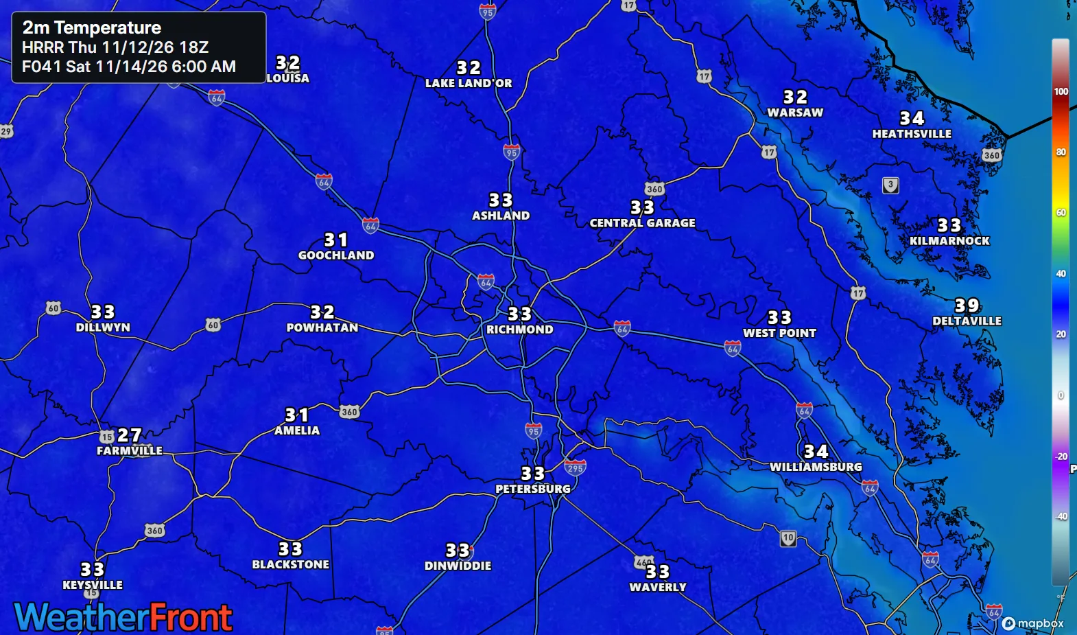
Sunday (Nov 15): Dry, high in the mid 50s inland, mid to upper 50s on the Northern Neck and the Lower Eastern Shore, northwest winds easing late as high pressure builds in. Low near to below freezing inland, mid 30s on the Northern Neck, upper 30s to lower 40s near the coast. Still winter's preview — just a calmer one.
AT A GLANCE
Fri: Cold, gusty NW — 54°
Sat: Sunny, coldest night — 52°
Sun: Dry, chilly, calmer — 55°
Next week: Dry — highs in the 50s, no rain in sight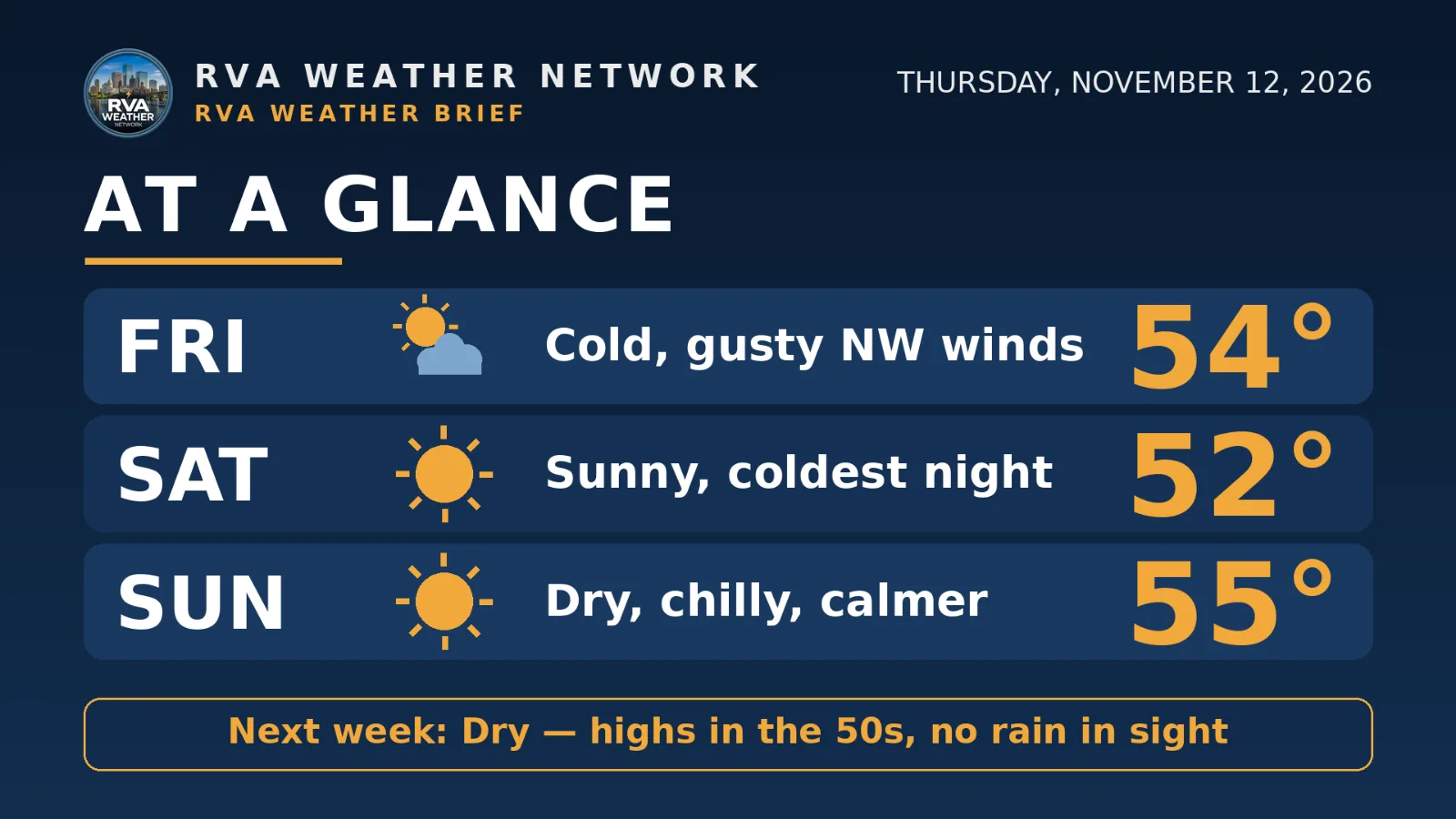
SPECIALIZED CALLOUTS
🌱 Gardening & Soil Brief: Friday evening is the hard deadline inland — the Freeze Watch, lows of 30-32°F, and widespread frost end the growing season for many inland; Saturday night's upper 20s finish the job. Harvest and bring tender pots in Friday; coastal gardens (upper 30s Friday night) get one extra night, not a pass.
🚗 Commute & Outdoor Rating: 8/10. All three days are dry, no rain or fog. Points come off for northwest gusts of 20-25 mph inland (25-30 mph at the coast) Friday and Saturday on bridges and exposed roads, and wind chills in the 20s early and late.
🏠 Home & Energy Brief: Heating demand peaks for the season so far — three straight nights near or below freezing inland, wind chills in the mid-upper 20s. Check the furnace and protect exposed pipes Friday before dark — not after the freeze sets in.
🚴 Two-Wheel & Runner's Outlook: Friday and Saturday are headwind days — northwest gusts of 20-25 mph, morning wind chills in the mid-upper 20s inland, the coldest starts of the season. Sunday is the pick: dry, winds easing late, mid-50s by afternoon after another freezing start inland.
COMMUNITY ENGAGEMENT
📩 Reader Mailbag is open — send us your weather question: Pick a lane — WINTER, FREEZE, RAIN, or SKY — plus your neighborhood, and send the full question at https://rvaweather.net/obs; we will answer one in an upcoming issue. Like this if yours has been sitting unasked all fall.
📩 Share & Subscribe: Send this to anyone with tender plants still outside, or weekend plans built on the mild week we just had — Friday night changes both. Get the brief in your inbox: https://rvaweather.net/newsletter
Thanks for reading the RVA Weather Brief — 100% free, from the RVA Weather Network team. Support our work at https://rvaweather.net/social. Built on the latest NWS Wakefield forecast discussion (2:31 PM EST Thu Nov 12, 2026 — the latest available at generation time; no post-3:00 PM discussion had been issued yet), with local context from the RVA Weather Network team. Keep an eye on the sky — and stay safe out there.
Comments