Weather U-Turn: Massive Ridge to Bring Summer Heat and Dry Skies
Substack
May 14, 2026, 9:17 PM
Weather U-Turn: Massive Ridge to Bring Summer Heat and Dry Skies

This evening, the air has a distinct bite to it, more like early April than mid-May. If you’ve been outside, you’ve likely noticed the widespread cloud cover and the scattered showers that dampened the afternoon.
We are currently under the influence of an upper-level trough—a dip in the jet stream—that has pulled cooler air into the region, keeping our temperatures a staggering 10–15 degrees below the seasonal average.

The Immediate Outlook: A Chilly Reset
As drier air filters in from the northwest tonight, those lingering showers and isolated storms in northeast North Carolina will fizzle out. If you have evening plans, grab a jacket:
Tonight: Clouds will clear from west to east. It’s going to be chilly, with inland lows dropping into the 40s.
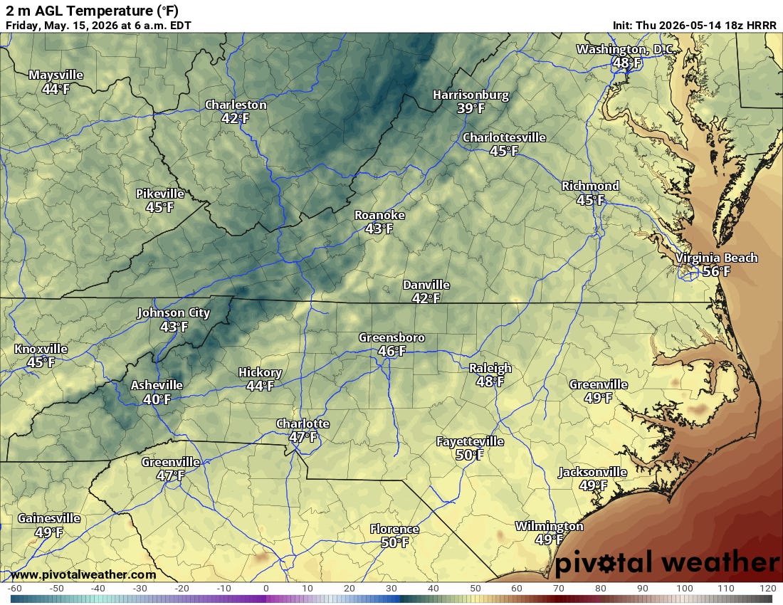
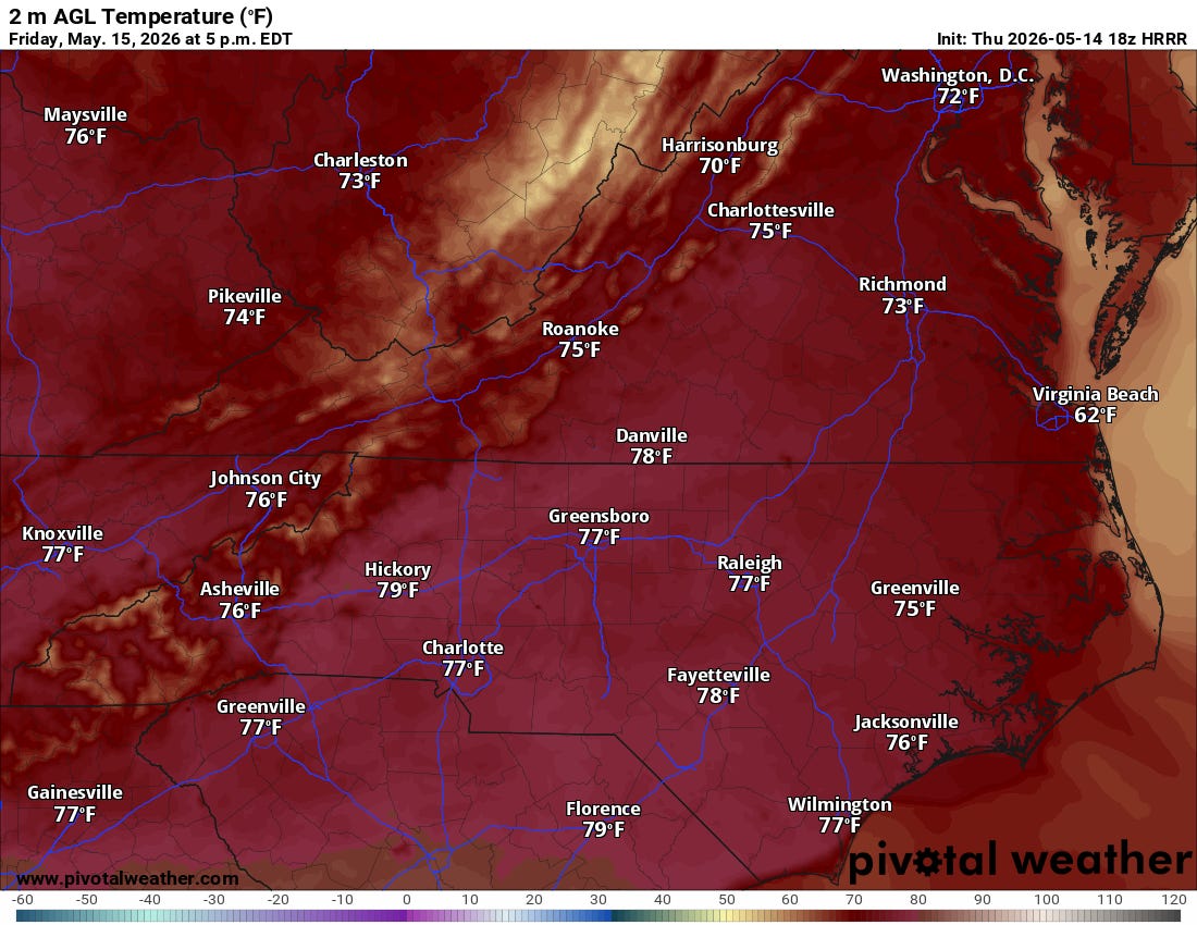
Friday: This will be the “Goldilocks” day. High pressure moves directly over us, bringing plentiful sunshine and very comfortable highs in the upper 60s to mid 70s.


The Big Shift: Summer is Crashing the Party
Enjoy the light jacket weather while it lasts, because the atmosphere is about to flip the switch from “Spring” to “July.”
Starting Saturday, that high-pressure system slides offshore and anchors itself near Bermuda. At the same time, a massive upper-level ridge (a “heat dome”) will build over the Eastern U.S. This setup creates a “southerly straw,” drawing hot, humid air up the coast.

The Heat Timeline:
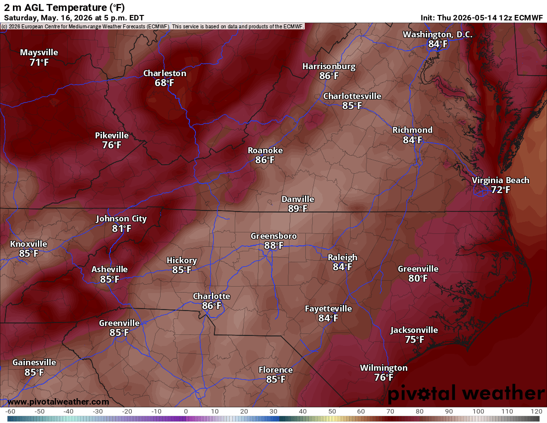
Saturday: We jump into the mid-to-upper 80s.
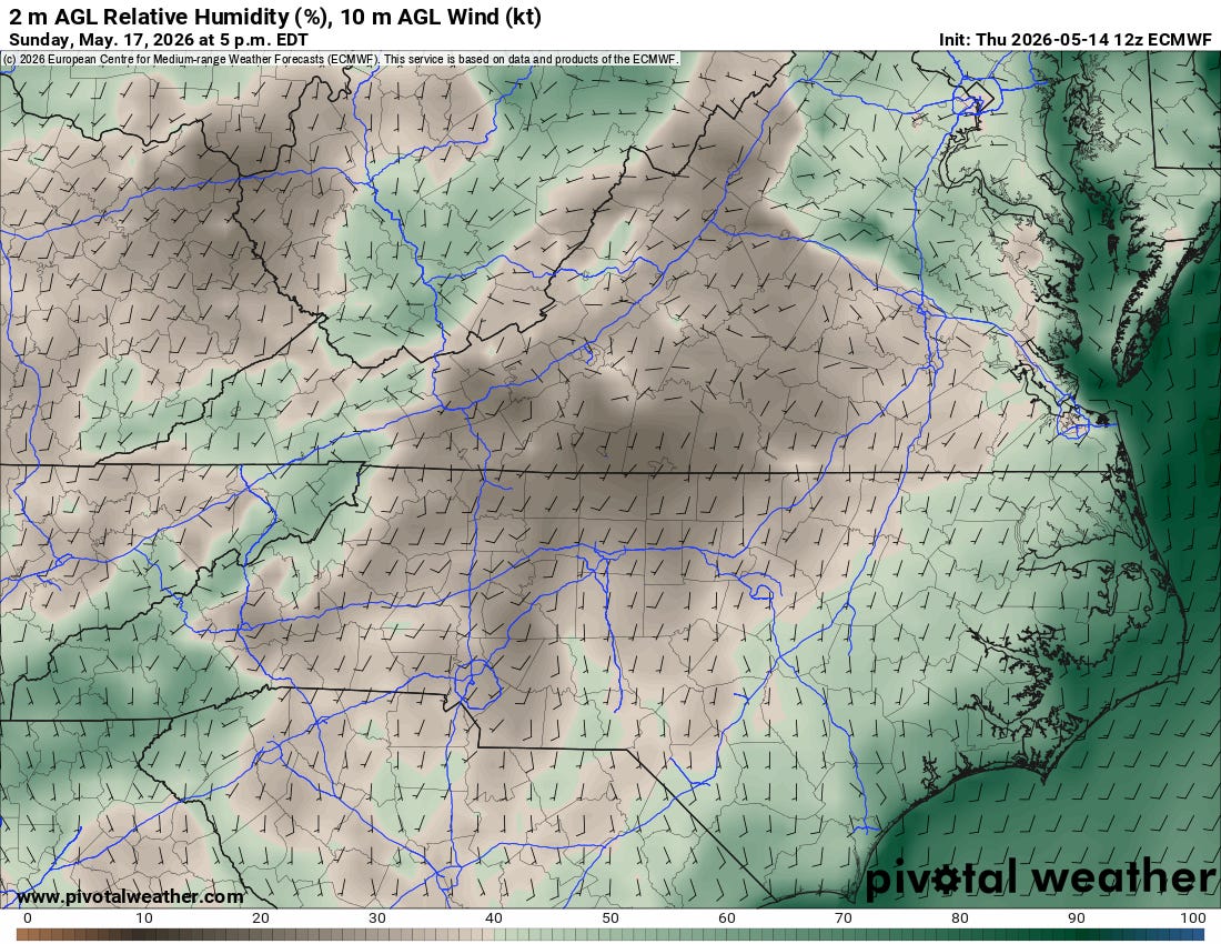
Sunday: Humidity rises as highs climb into the upper 80s and low 90s.
Monday – Wednesday: This is the peak of the heat wave. Inland areas should expect highs in the low to mid-90s. We may even see some record highs challenged, particularly around Richmond.
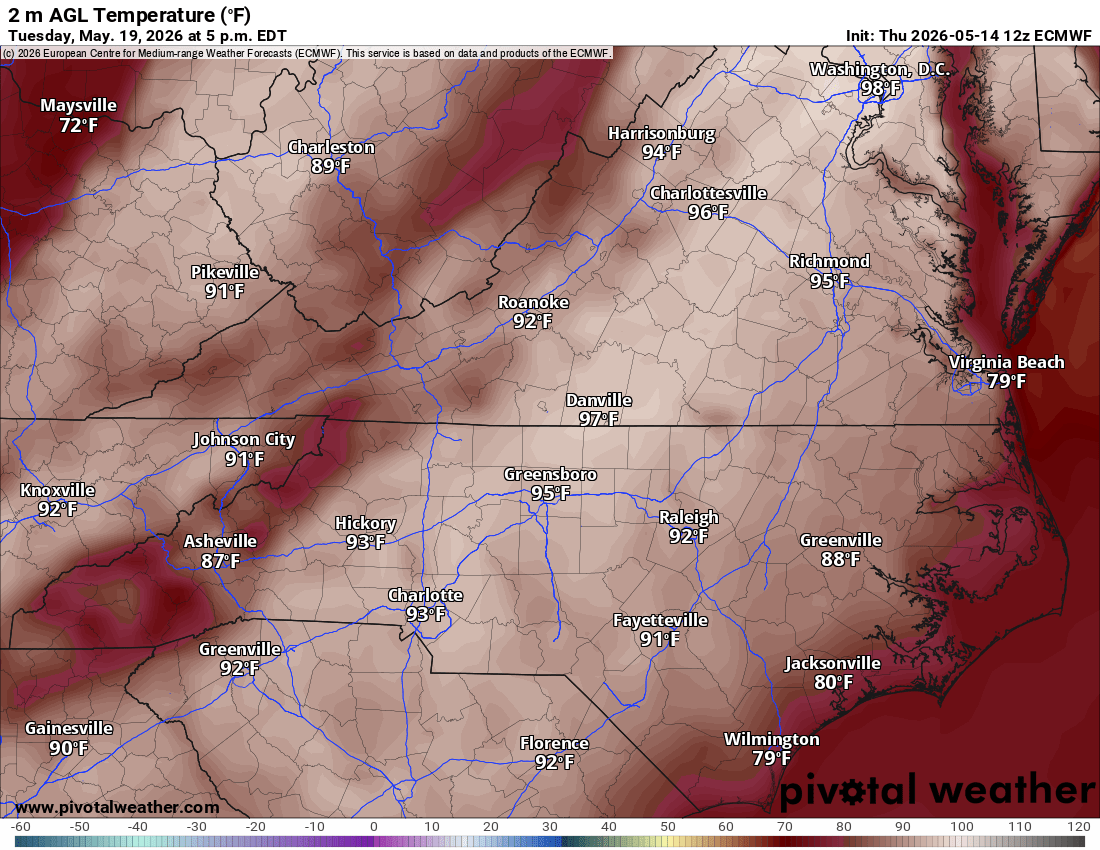


Note for the Coast: A “backdoor” cold front will try to slide down toward the Maryland Eastern Shore late Sunday. While most of us stay dry, there’s a small (<20%) chance of an isolated shower for our northern neighbors.
Marine & Aviation Update
Boaters: Small Craft Advisories remain in effect for the Chesapeake Bay and tidal rivers through Friday morning. Expect north winds of 15–20 knots tonight, with gusts up to 25 knots, before conditions significantly calm on Friday afternoon.
Pilots: Expect VFR conditions to prevail through the weekend. Aside from some mid-level cumulus tonight, skies will be clear, though a stray storm could pop up Sunday afternoon near the coast.
The Bottom Line: We are moving from a 40-degree wake-up call on Friday morning to 90-degree afternoons by Monday. It’s time to dust off the AC units and find the sunscreen—summer is arriving ahead of schedule.

Comments
(0)No observations yet. Be the first to share!