Mid-Atlantic Weather Update: Heavy Rain Tonight, Severe Storm Risk Wednesday
Substack
May 26, 2026, 9:12 PM
Mid-Atlantic Weather Update: Heavy Rain Tonight, Severe Storm Risk Wednesday

This evening, showers and thunderstorms capable of heavy rainfall are expected to stick around. If you feel like you’ve been living inside a humid sponge lately, you aren’t imagining it. A deep plume of moisture is pumping straight out of the Gulf of Mexico and into the Mid-Atlantic, setting the stage for a messy couple of days before we get a massive atmospheric reset.

Here is exactly what you need to know to plan your week.
Tonight: Heavy Rain & Muggy Conditions
Right now, a stationary front is draped right across the I-64 corridor. South of the front, storms are popping off; north of it, things are a bit quieter but still damp.

The Flood Threat: While tonight’s rain won’t be quite as widespread as last night’s deluge, we still have a “Slight Risk” for flash flooding. The main danger zone is the Piedmont region—especially if the heavy rain dumps on the same neighborhoods that got soaked yesterday.
The Severe Threat: Low. You might hear a few loud rumbles and catch an isolated wind gust up to 40 mph, but the atmospheric energy isn’t quite there to spark widespread severe weather tonight.
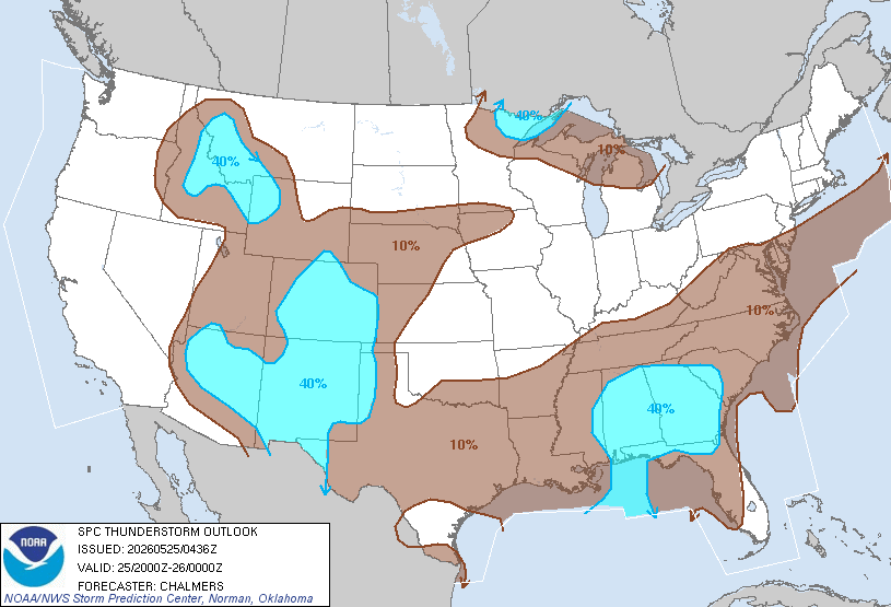
Overnight Navigation: Watch out for thick fog developing overnight, particularly across northeast areas and the Maryland Eastern Shore. Temperatures will be sticky, bottoming out in the mid-60s to lower 70s.
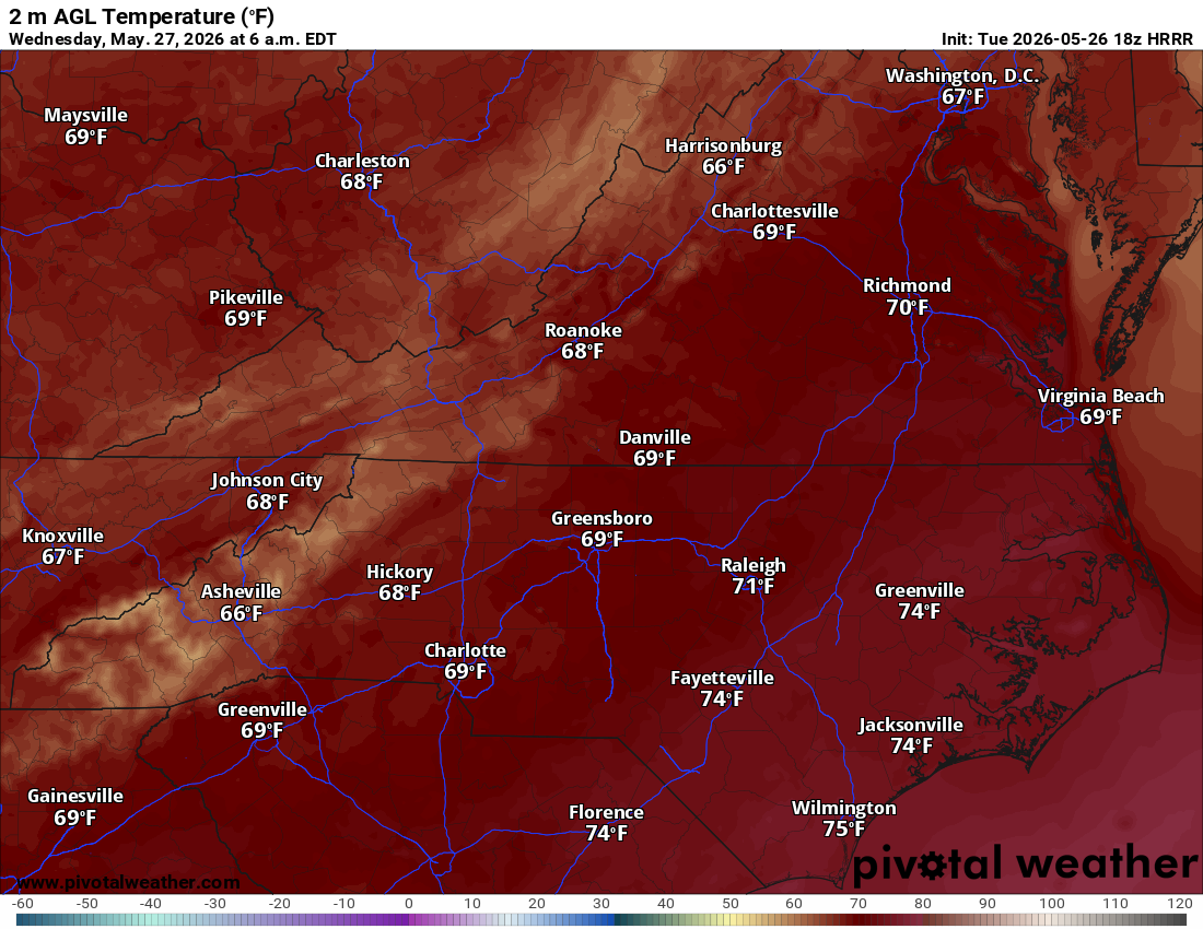


Wednesday: The Main Event (3 PM – 10 PM)
Wednesday starts deceptively quiet. Other than some lingering morning drizzle in the northeast, most of the morning and early afternoon should actually be dry.

Don’t let your guard down. That morning break is going to let the sun bake the region, cranking up the instability right before a strong cold front arrives from the north.
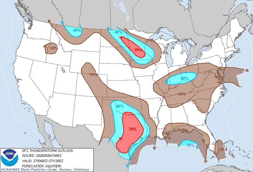
⚠️ STORM ALERT: The Storm Prediction Center has upgraded most of Virginia and Maryland to a Day 2 Slight Risk for severe weather.

Timing: The peak danger window is 3:00 PM to 10:00 PM.
Primary Threats: Organized storm clusters are expected to blast through. Damaging winds (with a 15% probability of localized destruction) are the main threat, alongside continued heavy rainfall.
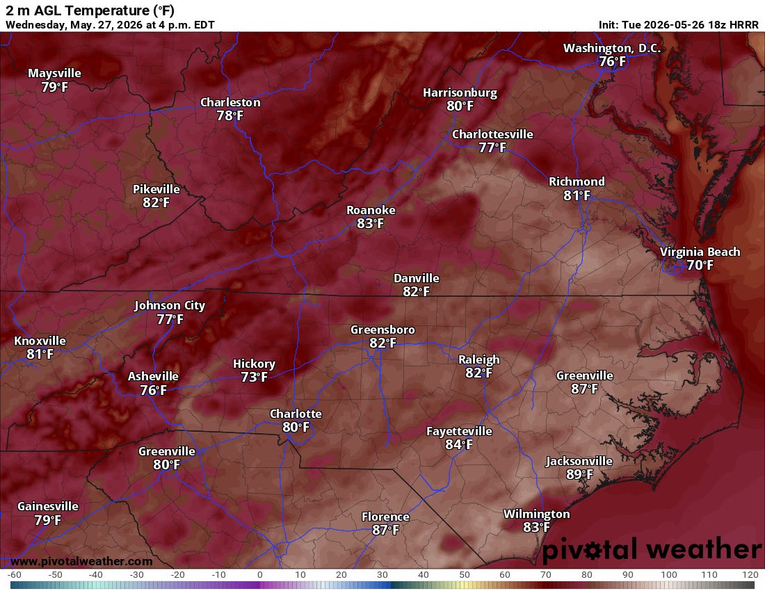
Temperature Highs: Expect a wide split—low to mid-80s in the north, stretching to a hot, muggy 90°F in the southeast.


The Reward: A GORGEOUS End to May
If you can survive Wednesday night’s storms, the weather gods are throwing us a massive bone. The cold front pushes completely south of us by Thursday morning, dragging away the humidity and shutting down the rain.

A secondary, dry reinforcement of cool air arrivals on Saturday from Canada. It will stay completely dry, meaning your outdoor plans for the final weekend of May and the start of June are 100% safe.

Stay weather-aware tomorrow afternoon, keep the umbrella handy, and look forward to Friday!
Be sure to check out rvaweather.net for the latest, and remember to stay safe out there!
Comments
(0)No observations yet. Be the first to share!