The Big Sweat: Triple-Digit RealFeel is on the Way
Substack
Jun 9, 2026, 9:20 PM
The Big Sweat: Triple-Digit RealFeel is on the Way

Enjoy the rest of this beautiful Tuesday evening, because the weather dynamic in our region is about to undergo a massive shift. The crisp, comfortable air mass that gave us 50-degree dew points today has officially packed its bags and moved offshore.
Behind it, a classic mid-summer setup is brewing: surging humidity, scattered storms, heat indices creeping past triple digits, and finally, a saving grace of a cold front just in time for the weekend.
Here is exactly what you need to know to plan out the rest of your week.

The Timeline: From Nice to Muggy to Melting
1. Tonight into Wednesday: The Humidity Shock
If you open your windows tonight, you’ll notice the change pretty quickly. As low-level winds shift to the south, high-octane moisture will flood the region.
Overnight: Clouds will thicken from west to east. A few spotty showers could break out after midnight (roughly 2 AM to 8 AM), particularly north and northwest of Richmond. Expect a much warmer night, with lows only dropping into the mid-60s to low 70s.
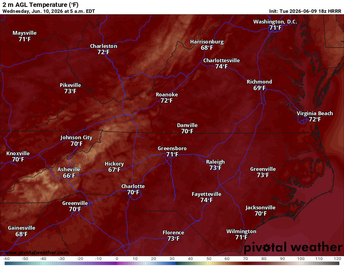
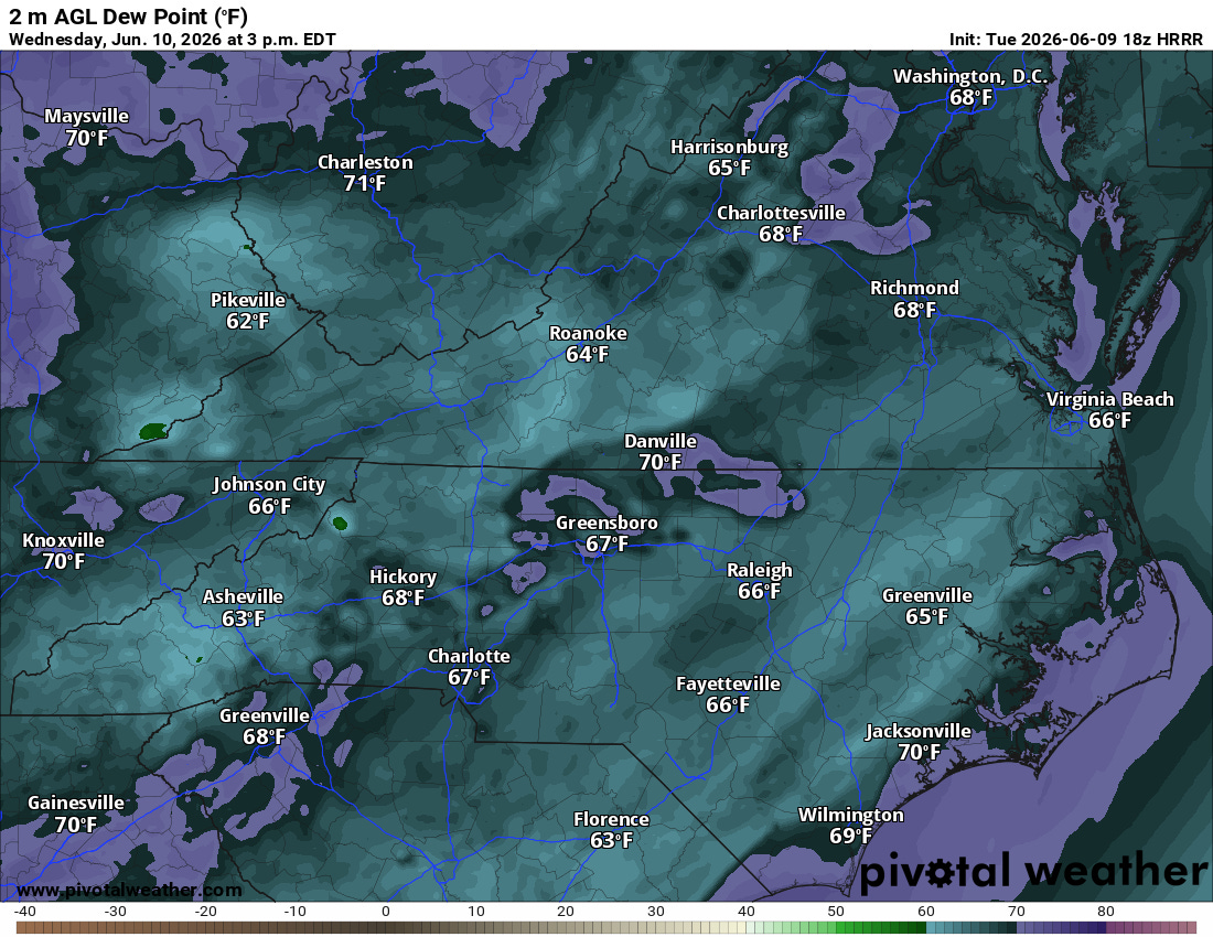
Wednesday Daytime: It’s going to feel like a different season. Highs will climb into the mid-to-upper 80s, but the real story is the dew points, which will skyrocket into the upper 60s and low 70s.
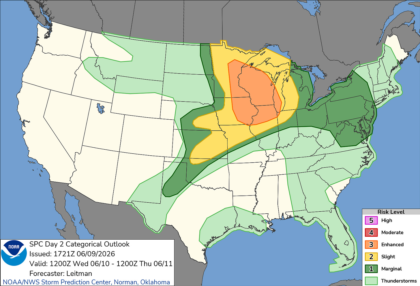
Storm Threat: Wednesday morning looks damp and cloudy. If those clouds clear out by the afternoon, the sun will cook up a highly unstable atmosphere. The northern half of our area is under a Marginal Risk for severe weather, meaning a few afternoon and evening storms could pack a punch with gusty winds.


2. Thursday & Friday: Peak Heat & Triple-Digit Feels
The heat crank turns all the way up for the end of the workweek as a massive upper-level ridge of high pressure anchors over the Southeast.
Expect actual afternoon temperatures to easily bake into the mid-to-upper 90s both days. When you factor in the thick humidity, heat index values are expected to hover between 100°F and 105°F.

Official Heat Advisories will likely be needed for parts of the area. We will also have to watch the skies each afternoon; passing atmospheric disturbances will bring daily, scattered “diurnal” (afternoon/evening) showers and thunderstorms. Thursday carries another Marginal Risk for a few severe storms.
3. The Weekend: A Tale of Two Microclimates
There is light at the end of the tunnel. A strong cold front will push down from Canada, crossing our area early Saturday morning. This front is going to hit the brakes on the extreme heat, but how much relief you get depends heavily on where you live.

The wind shift to the north-northeast behind the front is going to dramatically drop humidity levels area-wide, making even the 90-degree inland temperatures feel vastly more comfortable than Friday’s soup.
On the Water: Marine & Beach Outlook
If you are planning to be on the water or at the beach over the next 48 hours, keep a close eye on the wind and waves.
⚠️ Small Craft Advisories have been issued for the coastal waters north of Cape Charles Light starting Wednesday evening and lasting overnight.
Southerly winds will ramp up to 15–20 knots with gusts up to 25 knots on Wednesday, pushing seas up to 4 to 5 feet in the northern coastal waters. The Chesapeake Bay will be choppy (gusts up to 20 knots tonight into Wednesday), but should stay just below official advisory levels.

Rip Currents:
Tuesday: Moderate risk for all local beaches.
Wednesday: Moderate risk continues for northern beaches; dropping to low risk for southern beaches.
The Bottom Line: Wrap up any outdoor chores this evening while the air is still sweet. Drink plenty of water Thursday and Friday, and look forward to a much more bearable, lower-humidity weekend!

Want to stay ahead of the weather? Head over to rvaweather.net for your latest, hype-free local updates! 🌤️
Don’t forget—you are my eyes and ears on the ground. Got a backyard thermometer reading, rain gauge total, or a picture of the sky? Submit your own weather observations right on the site and join the crew!
As always, keep an eye on the sky and stay safe out there! 👋
Comments
(0)No observations yet. Be the first to share!