Heat, Storms, then a Stellar Weekend
Substack
Jun 16, 2026, 8:57 PM
Heat, Storms, then a Stellar Weekend

This evening, a Marginal Risk (Level 1 of 5) for isolated strong to severe storms has been introduced over coastal portions of the VA Northern Neck and Lower Eastern Shore, mainly for late this evening and overnight.

A weak low-pressure system moving off the North Carolina coast is pulling a stalled front back north as a warm front. While things will stay mostly quiet for the interior, this boundary will likely trigger scattered showers and a few isolated, stronger storms along the coast late tonight—mainly after midnight. If you’re in the Northern Neck or the Lower Eastern Shore, keep an ear out for a few rumbles of thunder; the main threats with any stronger cells will be small hail and gusty winds.
The Big Story: Thursday is Getting Hotter and Drier
If you’ve been tracking the timing of our next major cold front, the models have shifted. Trends continue to favor a later start time for showers and storms on Thursday.
What does that mean for your week?
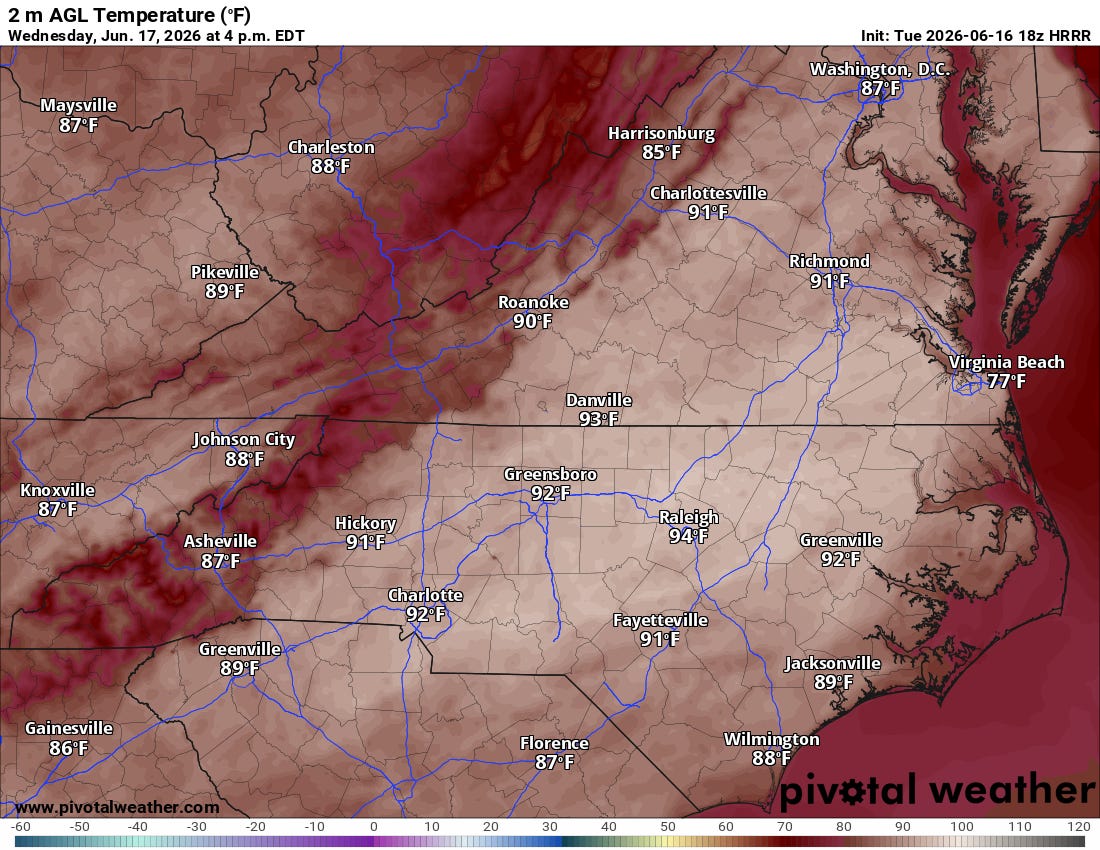
Wednesday: We transition into a much warmer, more humid airmass behind tonight’s warm front. Expect highs in the upper 80s to around 90°F, with heat index values climbing toward 100°F.
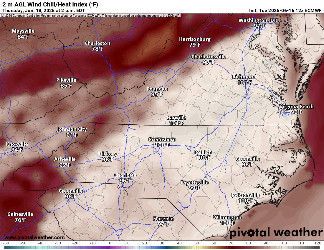
Thursday: Because the incoming front is slowing down, Thursday is now looking like a hotter, drier day overall. Westerly downslope winds will help “mix out” some of the early-morning humidity, making the afternoon feel a bit drier—but the ambient heat is surging. We’ve nudged up temperatures well into the mid-to-upper 90s. Given the remaining humidity, expect heat index values between 100°F and 105°F. Heat advisories may very well be needed.


Thursday Night: Severe Weather Potential
Because the front has slowed, the window for showers and storms has pushed into Thursday evening and overnight.
While losing the heat of the day usually weakens storms, forecast soundings are showing a highly unstable lower atmosphere (high DCAPE). Translated into plain English: the air near the ground will be very hot and dry, which sets the stage for cold-pool dominant storms.

The Primary Threat: Instead of a massive, organized line of tornadoes, the main risk Thursday evening will be localized convective outflows—essentially, storms collapsing and slamming isolated damaging wind gusts (downbursts) down to the surface.
The highest probability for these strong-to-severe storms will focus across the VA Piedmont, through the Richmond metro, and into the Northern Neck Thursday evening.

Looking Ahead: A Rainy Friday Morning, Then a Beautiful Weekend
The cold front will finally push through Friday morning, bringing a wave of welcome, measurable rainfall as Gulf moisture overruns the boundary. Fortunately, it looks like it will be a quick mover. Rapid clearing is expected by Friday afternoon and night, and multi-model guidance shows any tropical moisture to our south staying completely away from us.

Gradual clearing late Friday gives way to a mainly dry, pleasant weekend. Expect seasonable temperatures, plenty of sunshine, and beautifully low humidity levels just in time for Saturday and Sunday.
Marine Outlook Briefing
For our boaters and mariners, enjoy the benign conditions through Wednesday. A tight gradient ahead of Thursday’s front will bring elevated SW winds (15-20 knots, gusts to 25+ knots) to the Chesapeake Bay and coastal waters. Small Craft Advisories will likely be required starting Thursday morning, before winds shift to the North/Northwest and diminish on Friday behind the front.

Stay weather-aware Thursday evening, keep hydrated, and look forward to a fantastic weekend ahead!
Want to stay ahead of the weather? Head over to rvaweather.net for your latest, hype-free local updates! 🌤️
Don’t forget—you are my eyes and ears on the ground. Got a backyard thermometer reading, rain gauge total, or a picture of the sky? Submit your own weather observations right on the site and join the crew!
As always, keep an eye on the sky and stay safe out there! 👋
Comments
(0)No observations yet. Be the first to share!